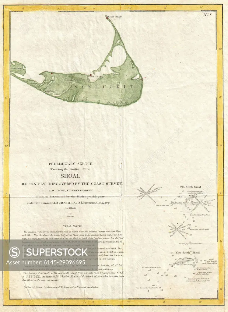
1846 U.S. Coast Survey Map of Nantucket (first U.S.C.S. Map of the Davis Shoals)
SuperStock offers millions of photos, videos, and stock assets to creatives around the world. This image of Explore Historical American Cartography: Detailed Map of Nantucket Shoal from Coast Survey Archives by Piemags/PL Photography Limited is available for licensing today.
DETAILS
Image Number: 6145-29096695Royalty FreeCredit Line:Piemags/PL Photography Limited/SuperStockCollection: