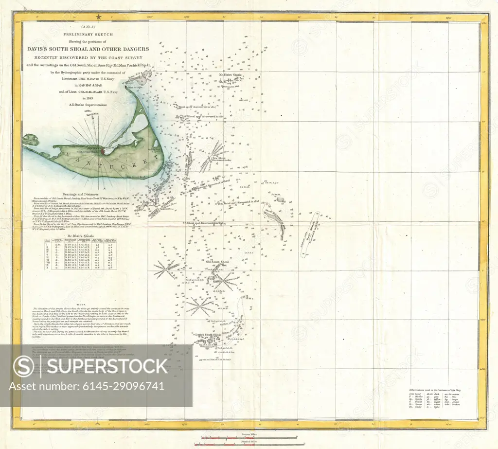
1849 U.S. Coast Survey Map of Nantucket and the Davis Shoals
SuperStock offers millions of photos, videos, and stock assets to creatives around the world. This image of Explore Historic Maritime Navigation: Detailed Vintage Map of Hatteras Inlet and Surrounding Coastlines by Piemags/PL Photography Limited is available for licensing today.
DETAILS
Image Number: 6145-29096741Royalty FreeCredit Line:Piemags/PL Photography Limited/SuperStockCollection: