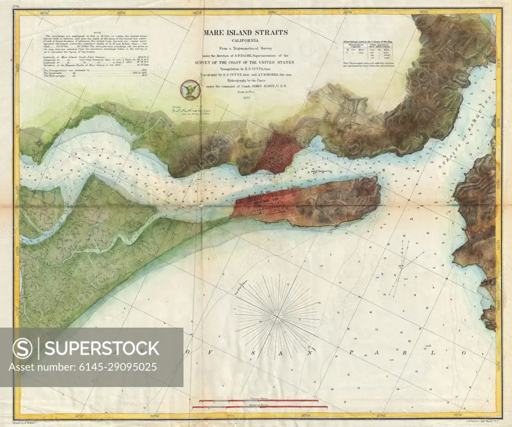
1857 U.S. Coast Survey Map of the Mare Island Straits, Vallejo, and the Napa River (Near San Franci
SuperStock offers millions of photos, videos, and stock assets to creatives around the world. This image of Explore the Historic Mare Island Straits: Vintage Nautical Map of California's Scenic Waterway by Piemags/PL Photography Limited is available for licensing today.
Looking for a license?
Click here, and we'll help you find it! Questions? Just ask!
Click here, and we'll help you find it! Questions? Just ask!
DETAILS
Image Number: 6145-29095025Royalty FreeCredit Line:Piemags/PL Photography Limited/SuperStockCollection:PL Photography Limited Contributor:Piemags Model Release:NoProperty Release:NoResolution:4000×3341