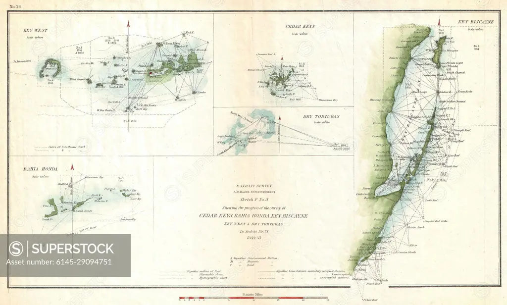
1853 U.S. Coast Survey Map of Key Biscayne Bay, Key West and the Cedar Keys, Florida
SuperStock offers millions of photos, videos, and stock assets to creatives around the world. This image of Explore Historical Cartography: Detailed Vintage Map of Key Islands and Coastal Dockyards in 1871 by Piemags/PL Photography Limited is available for licensing today.
Looking for a license?
Click here, and we'll help you find it! Questions? Just ask!
Click here, and we'll help you find it! Questions? Just ask!
DETAILS
Image Number: 6145-29094751Royalty FreeCredit Line:Piemags/PL Photography Limited/SuperStockCollection:PL Photography Limited Contributor:Piemags Model Release:NoProperty Release:NoResolution:3000×1805