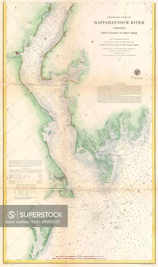
1857 U.S. Coast Survey Map or Chart of the Rapphannock River South, Virginia
SuperStock offers millions of photos, videos, and stock assets to creatives around the world. This image of Explore the Historic Rappahannock River with This Detailed Vintage Map of Virginia's Waterways - Perfect for Nautical Enthusiasts and History Buffs! by Piemags/PL Photography Limited is available for licensing today.
Looking for a license?
Click here, and we'll help you find it! Questions? Just ask!
Click here, and we'll help you find it! Questions? Just ask!
DETAILS
Image Number: 6145-29095037Royalty FreeCredit Line:Piemags/PL Photography Limited/SuperStockCollection: