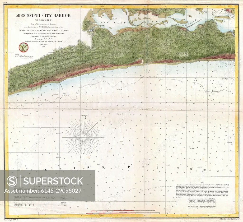
1857 U.S. Coast Survey Map or Chart of Mississippi City Harbor, Mississippi
SuperStock offers millions of photos, videos, and stock assets to creatives around the world. This image of Explore the detailed 19th-century nautical chart of Mississippi City Harbor, perfect for history enthusiasts and maritime researchers. by Piemags/PL Photography Limited is available for licensing today.
DETAILS
Image Number: 6145-29095027Royalty FreeCredit Line:Piemags/PL Photography Limited/SuperStockCollection: