1877 U.S. Coast Survey Map or Chart of Boston Bay and Harbor

1877 U.S. Coast Survey Map or Chart of Boston Bay and Harbor
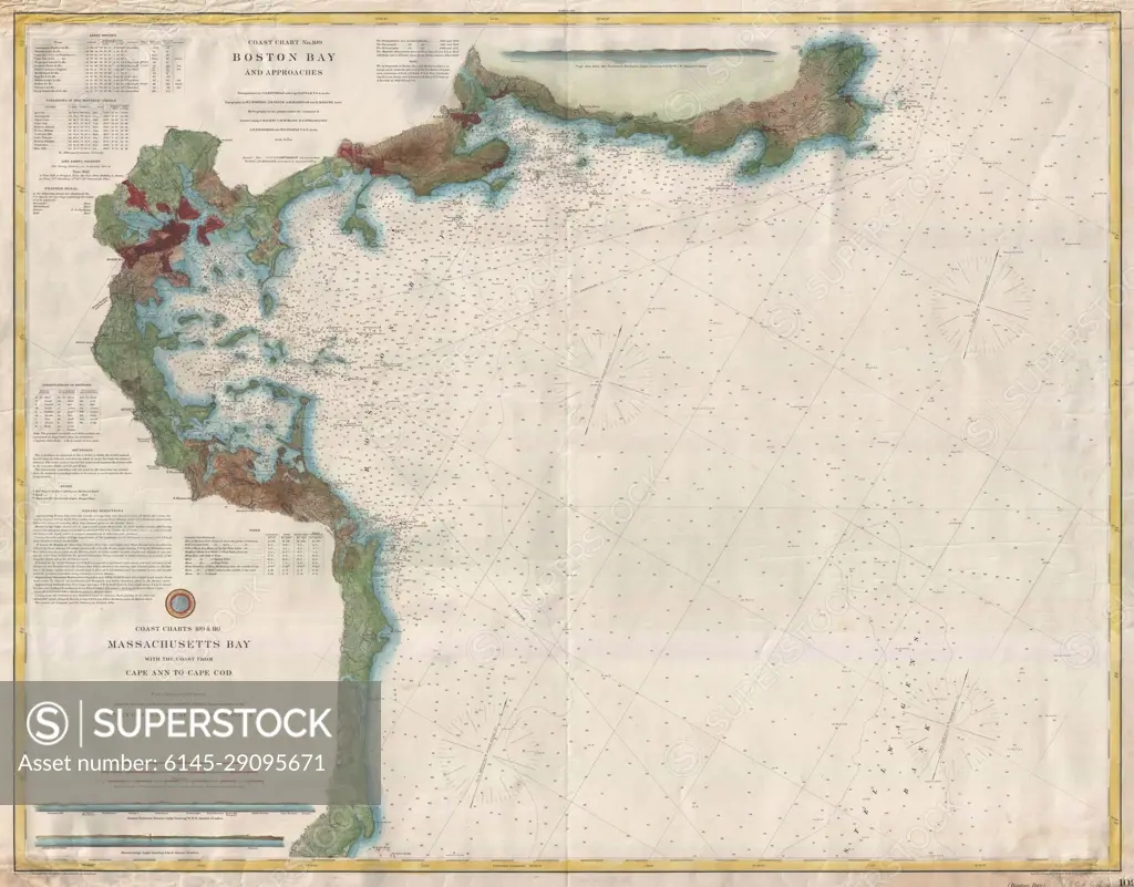
SuperStock offers millions of photos, videos, and stock assets to creatives around the world. This image of Explore Historical Maritime Navigation: Antique Map of Massachusetts Bay and Boston Harbor - A Glimpse into 19th Century Cartography! by Piemags/PL Photography Limited is available for licensing today.
Royalty Free License
Royalty-Free Standard Commercial licenses are granted for worldwide, non-exclusive and perpetual use, unless specifically noted otherwise. All Royalty-Free transactions are final. The Royalty-Free Standard Commercial license has no limitations and covers up to 15 users.
  • $50.00 Low500 X 392
  • $150.00 Med750 X 587
  • $250.00 High6000 X 4698
  • Download your images from the download tab on this page after purchase.
  • Up to 5 downloads
  • Can be used for a year after purchase.
$1,225.00
RF High / Super Res 5 Pack
Save $25.00
$245.00
per download
Order a Framed Print
DETAILS
Image Number:  6145-29095671Royalty FreeCredit Line:Piemags/PL Photography Limited/SuperStockCollection:Contributor:Model Release:NoProperty Release:NoResolution:6000×4698
|
|
|
|
|
|
|