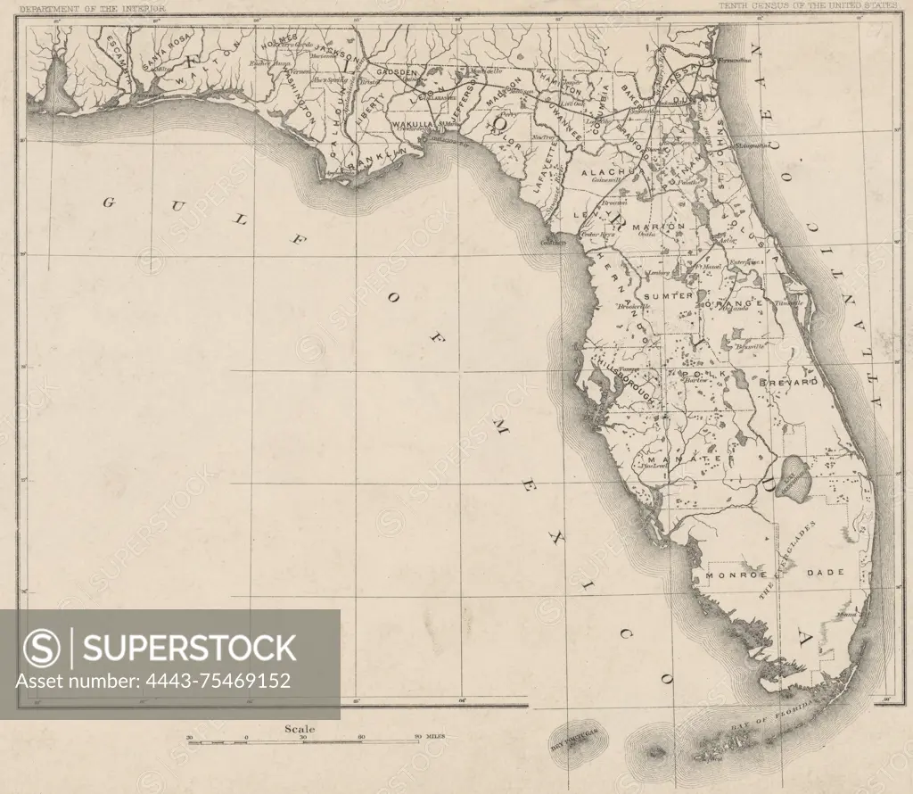
Cities and county map of the states of Florida, prepared for the 10th census, 1880. Tenth census of the United States, 1884., Washington, D.C. Publisher, Census Office. Florida, Administrative and political divisions, United States, Census, 1880., 1 map; 21 x 24 cm, on sheet 25 x 31 cm
SuperStock offers millions of photos, videos, and stock assets to creatives around the world. This image of Cities and county map of the states of Florida, prepared for the 10th census, 1880. Tenth census of the United States, 1884., Washington, D.C. Publisher, Census Office. Florida, Administrative and political divisions, United States, Census, 1880., 1 map; 21 x 24 cm, on sheet 25 x 31 cm by Artokoloro is available for licensing today.
Looking for a license?
Click here, and we'll help you find it! Questions? Just ask!
Click here, and we'll help you find it! Questions? Just ask!
DETAILS
Image Number: 4443-75469152Rights ManagedCredit Line:Artokoloro/SuperStockCollection:Artokoloro Model Release:NoProperty Release:NoResolution:5700×4956