A chart titled 'A chart of the West Indies from Cape Cod to ye River Oronoque,' created in 1682 by Anne Godbid and John Playford. The map is hand-colored and measures 12 x 14 cm, folded to 15 x 8 cm. It depicts various regions including the West Indies, the Atlantic Coast of North America, Mexico, and the Gulf of Mexico. The map was published in London by A. Godbid and J. Playford for John Seller
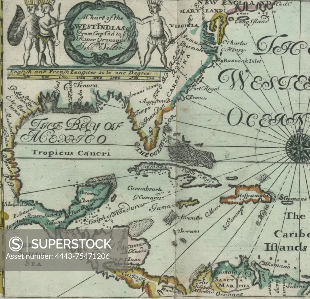
SuperStock offers millions of photos, videos, and stock assets to creatives around the world. This image of A chart titled 'A chart of the West Indies from Cape Cod to ye River Oronoque,' created in 1682 by Anne Godbid and John Playford. The map is hand-colored and measures 12 x 14 cm, folded to 15 x 8 cm. It depicts various regions including the West Indies, the Atlantic Coast of North America, Mexico, and the Gulf of Mexico. The map was published in London by A. Godbid and J. Playford for John Seller by Artokoloro is available for licensing today.
Looking for a license?
Click here, and we'll help you find it! Questions? Just ask!
Click here, and we'll help you find it! Questions? Just ask!
DETAILS
Image Number: 4443-75471206Rights ManagedCredit Line:Artokoloro/SuperStockCollection:Artokoloro Model Release:NoProperty Release:NoResolution:4339×4190