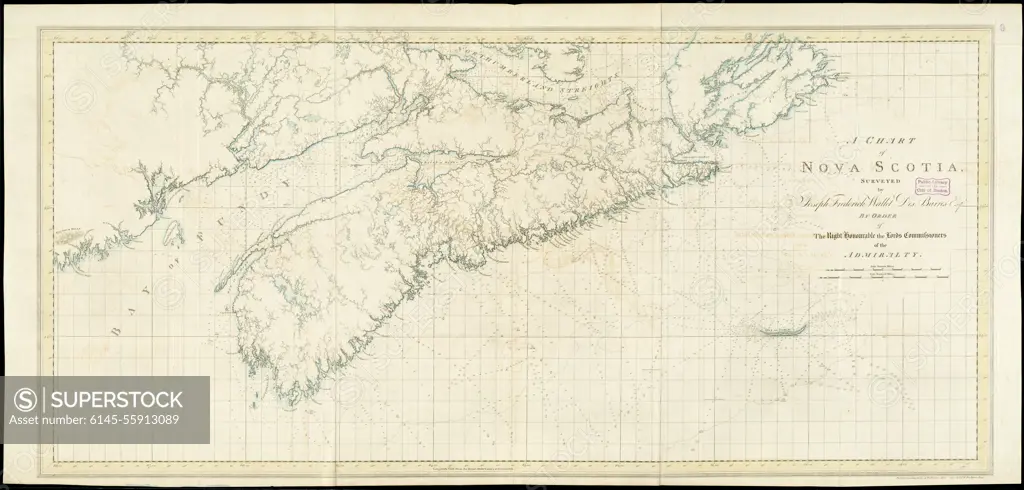
A chart of Nova Scotia. Map of all of Nova Scotia, except the northern extremity of Cape Breton Island. Depths shown by soundings. Appears in the author's Atlantic Neptune. London : J.F.W. Des Barres, 1777-1781.... , Canada , Nova Scotia ,province
SuperStock offers millions of photos, videos, and stock assets to creatives around the world. This image of A chart of Nova Scotia. Map of all of Nova Scotia, except the northern extremity of Cape Breton Island. Depths shown by soundings. Appears in the author's Atlantic Neptune. London : J.F.W. Des Barres, 1777-1781.... , Canada , Nova Scotia ,province by Piemags/PL Photography Limited is available for licensing today.
Looking for a license?
Click here, and we'll help you find it! Questions? Just ask!
Click here, and we'll help you find it! Questions? Just ask!
DETAILS
Image Number: 6145-55913089Royalty FreeCredit Line:Piemags/PL Photography Limited/SuperStockCollection:PL Photography Limited Story:Colonial American MapsContributor:Piemags Model Release:NoProperty Release:NoResolution:16036×7675