1864 U.S.C.S. Chart of the Mississippi River Grand Gulf to New Carthage (Jefferson Davis Plantation)
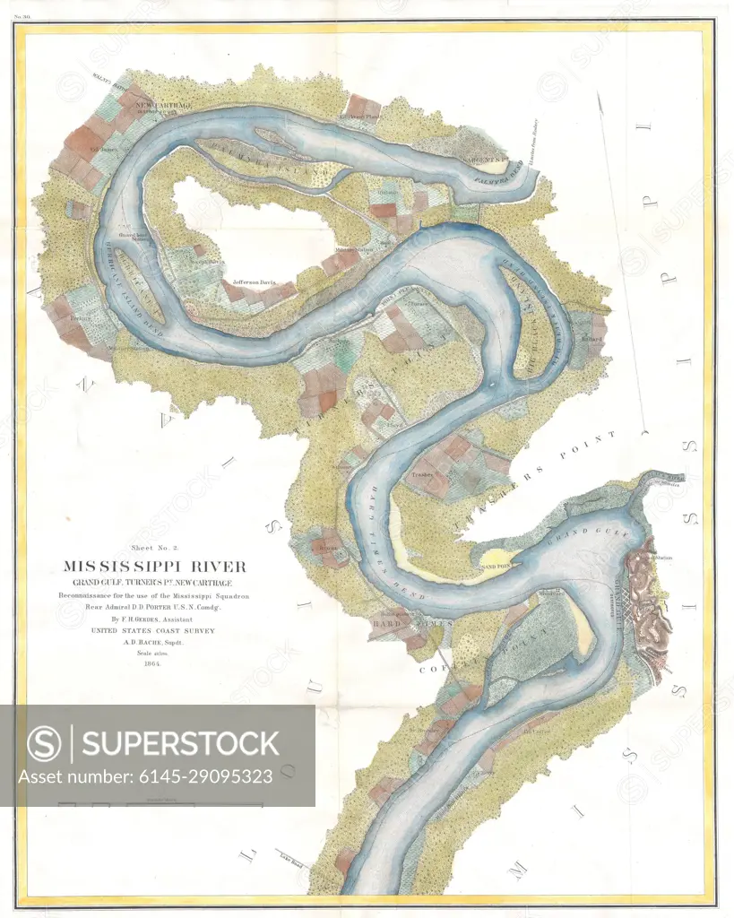
SuperStock offers millions of photos, videos, and stock assets to creatives around the world. This image of Explore Historical Maps: Detailed 1866 Mississippi River Meander Path Chart by Piemags/PL Photography Limited is available for licensing today.
Looking for a license?
Click here, and we'll help you find it! Questions? Just ask!
Click here, and we'll help you find it! Questions? Just ask!
DETAILS
Image Number: 6145-29095323Royalty FreeCredit Line:Piemags/PL Photography Limited/SuperStockCollection: