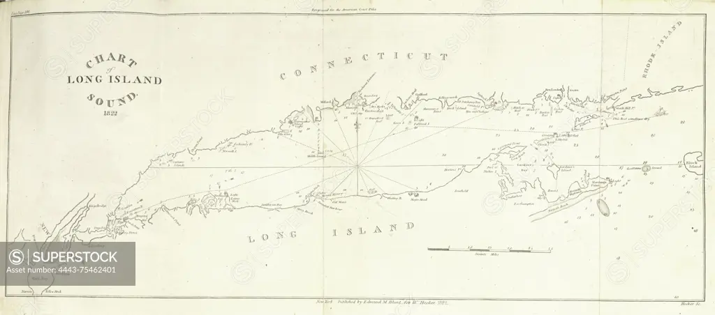
Chart of Long Island Sound, 1822, created by Edmund M. Blunt. The chart measures 19 x 43 cm, folded to 22 x 14 cm. It was published in New York by E.M. Blunt for W. Hooker. The chart includes nautical information relevant to the Atlantic Coast of North America and South America, specifically focusing on the areas of New York, Connecticut, and Long Island Sound
SuperStock offers millions of photos, videos, and stock assets to creatives around the world. This image of Chart of Long Island Sound, 1822, created by Edmund M. Blunt. The chart measures 19 x 43 cm, folded to 22 x 14 cm. It was published in New York by E.M. Blunt for W. Hooker. The chart includes nautical information relevant to the Atlantic Coast of North America and South America, specifically focusing on the areas of New York, Connecticut, and Long Island Sound by Artokoloro is available for licensing today.
Looking for a license?
Click here, and we'll help you find it! Questions? Just ask!
Click here, and we'll help you find it! Questions? Just ask!
DETAILS
Image Number: 4443-75462401Rights ManagedCredit Line:Artokoloro/SuperStockCollection:Artokoloro Model Release:NoProperty Release:NoResolution:4263×1883