A chart of the eastern coast of Africa, spanning from the thirteenth degree of South to the sixteenth degree of North latitude, created between 1745 and 1747 by Thomas Astley. This chart was published in London by T. Astley. Engravings are featured within the chart
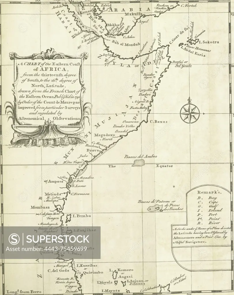
SuperStock offers millions of photos, videos, and stock assets to creatives around the world. This image of A chart of the eastern coast of Africa, spanning from the thirteenth degree of South to the sixteenth degree of North latitude, created between 1745 and 1747 by Thomas Astley. This chart was published in London by T. Astley. Engravings are featured within the chart by Artokoloro is available for licensing today.
Looking for a license?
Click here, and we'll help you find it! Questions? Just ask!
Click here, and we'll help you find it! Questions? Just ask!
DETAILS
Image Number: 4443-75459699Rights ManagedCredit Line:Artokoloro/SuperStockCollection:Artokoloro Model Release:NoProperty Release:NoResolution:2568×3235