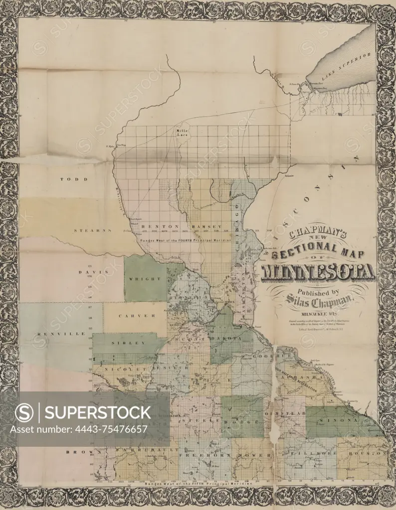
Chapman's new sectional map of Minnesota, published in 1856 by Silas Chapman in Milwaukee, Wisconsin. The map is hand-colored and measures 66 x 53 cm, folded within covers measuring 15 x 10 cm. It features public lands, Indian reservations, roads, counties, and administrative and political divisions of Minnesota. The NYPL Map Division copy is encased in mylar and filed flat with its original covers
SuperStock offers millions of photos, videos, and stock assets to creatives around the world. This image of Chapman's new sectional map of Minnesota, published in 1856 by Silas Chapman in Milwaukee, Wisconsin. The map is hand-colored and measures 66 x 53 cm, folded within covers measuring 15 x 10 cm. It features public lands, Indian reservations, roads, counties, and administrative and political divisions of Minnesota. The NYPL Map Division copy is encased in mylar and filed flat with its original covers by Artokoloro is available for licensing today.
Looking for a license?
Click here, and we'll help you find it! Questions? Just ask!
Click here, and we'll help you find it! Questions? Just ask!
DETAILS
Image Number: 4443-75476657Rights ManagedCredit Line:Artokoloro/SuperStockCollection:Artokoloro Model Release:NoProperty Release:NoResolution:4421×5700