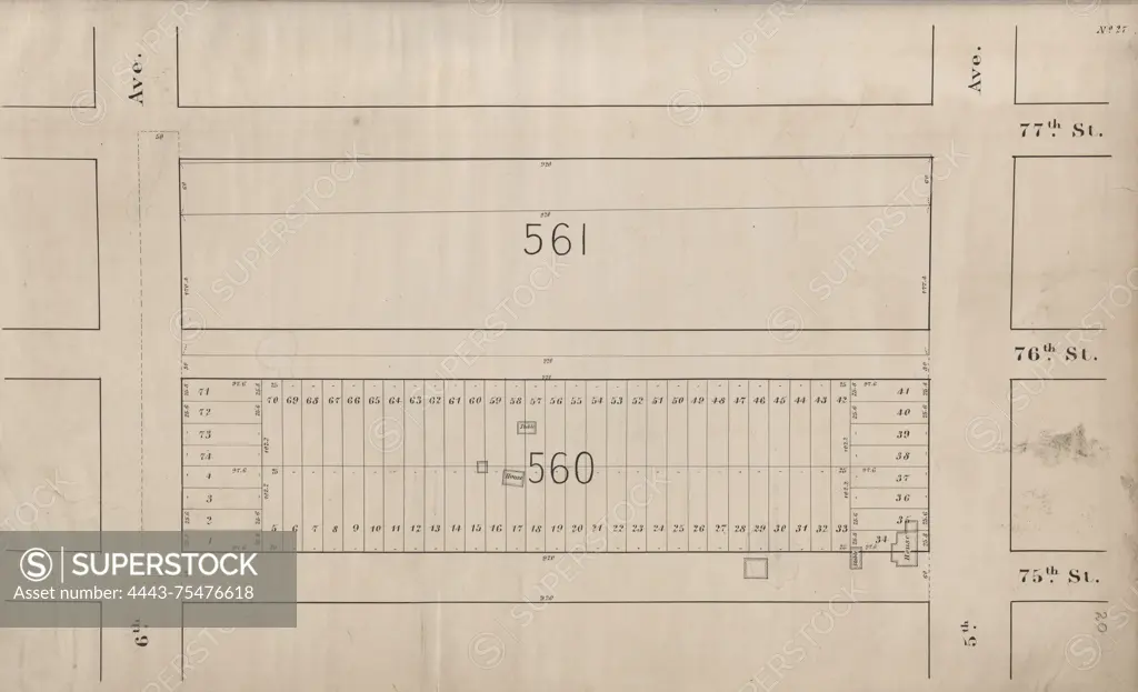
Central Park Planning Map No. 27 Bounded by 77th Street, 5th Avenue, 75th Street and 6th Avenue, 1853, New York (N.Y.)., 1853, New York, New York (N.Y.), Central Park (New York, N.Y.), City planning
SuperStock offers millions of photos, videos, and stock assets to creatives around the world. This image of Central Park Planning Map No. 27 Bounded by 77th Street, 5th Avenue, 75th Street and 6th Avenue, 1853, New York (N.Y.)., 1853, New York, New York (N.Y.), Central Park (New York, N.Y.), City planning by Artokoloro is available for licensing today.
Looking for a license?
Click here, and we'll help you find it! Questions? Just ask!
Click here, and we'll help you find it! Questions? Just ask!
DETAILS
Image Number: 4443-75476618Rights ManagedCredit Line:Artokoloro/SuperStockCollection:Artokoloro Model Release:NoProperty Release:NoResolution:5700×3470