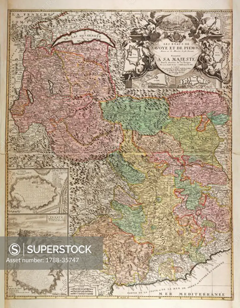
Cartography, Italy, 17th century. States of Savoy and Piedmont, maps of Turin, Vercelli, Ivrea, Carmagnola, Montmallan and the citadel of Verrua. Map by Jean Baptiste Nolan, Paris, 1698. Copper engraving.
SuperStock offers millions of photos, videos, and stock assets to creatives around the world. This image of Cartography, Italy, 17th century. States of Savoy and Piedmont, maps of Turin, Vercelli, Ivrea, Carmagnola, Montmallan and the citadel of Verrua. Map by Jean Baptiste Nolan, Paris, 1698. Copper engraving. by DeAgostini is available for licensing today.
Looking for a license?
Click here, and we'll help you find it! Questions? Just ask!
Click here, and we'll help you find it! Questions? Just ask!
DETAILS
Image Number: 1788-35747Rights ManagedCredit Line:DeAgostini/SuperStockCollection:DeAgostini Model Release:NoProperty Release:NoResolution:4128×5285