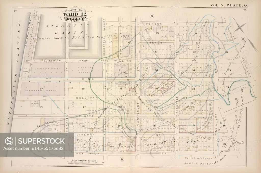
Cartographic, Maps. 1880. Lionel Pincus and Princess Firyal Map Division. Brooklyn (New York, N.Y.), Real property , New York (State) , New York Vol. 5. Plate, Q. Map bound by Atlantic Basin, Verona St., Columbia St., Otsego St., Partition St., Buttermilk Channel; Including Tremont St., Clinton Wharf, William St., King St., Sullivan St., Bush St., Wolcott St., Dikeman St., South Piers, Ferris St., Imlay St., Commercial Wharf, Conover St., Van Brunt St., Richards St., Dwight St.
SuperStock offers millions of photos, videos, and stock assets to creatives around the world. This image of Cartographic, Maps. 1880. Lionel Pincus and Princess Firyal Map Division. Brooklyn (New York, N.Y.), Real property , New York (State) , New York Vol. 5. Plate, Q. Map bound by Atlantic Basin, Verona St., Columbia St., Otsego St., Partition St., Buttermilk Channel; Including Tremont St., Clinton Wharf, William St., King St., Sullivan St., Bush St., Wolcott St., Dikeman St., South Piers, Ferris St., Imlay St., Commercial Wharf, Conover St., Van Brunt St., Richards St., Dwight St. by piemags/PL Photography Limited is available for licensing today.
Looking for a license?
Click here, and we'll help you find it! Questions? Just ask!
Click here, and we'll help you find it! Questions? Just ask!
DETAILS
Image Number: 6145-55175682Royalty FreeCredit Line:piemags/PL Photography Limited/SuperStockCollection:PL Photography Limited Contributor:piemags Model Release:NoProperty Release:NoResolution:6432×4271