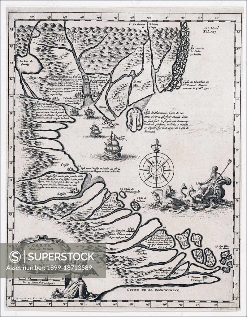
Carte faite sur les lieux par Daniel Tavernier en plusieurs voiages qu´il a fait au Tonquin' or 'Map of the places visited by Daniel Tavernier during several voyages to Tonkin'. Map / Chart by Jan Luyken (1649-1712). China's Hainan Island is shown, but not the Paracels of Spratlys Islands.
SuperStock offers millions of photos, videos, and stock assets to creatives around the world. This image of Carte faite sur les lieux par Daniel Tavernier en plusieurs voiages qu´il a fait au Tonquin' or 'Map of the places visited by Daniel Tavernier during several voyages to Tonkin'. Map / Chart by Jan Luyken (1649-1712). China's Hainan Island is shown, but not the Paracels of Spratlys Islands. by Pictures From History/Universal Images is available for licensing today.
Looking for a license?
Click here, and we'll help you find it! Questions? Just ask!
Click here, and we'll help you find it! Questions? Just ask!
DETAILS
Image Number: 1899-18713589Rights ManagedCredit Line:Pictures From History/Universal Images/SuperStockCollection: