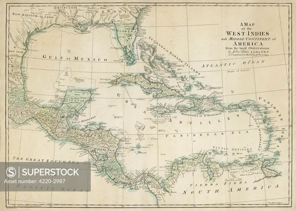
The Caribbean, with the WestIndies, and the coasts of theUnited States and the Spanishpossessions which later becameTexas and Mexico, and thenorthern coast of S. America. Date: late 18th century
SuperStock offers millions of photos, videos, and stock assets to creatives around the world. This image of Explore the Rich History of the West Indies with This Vintage Map of Colonial America and the Caribbean. by Mary Evans Picture Library/Pantheon is available for licensing today.
Looking for a license?
Click here, and we'll help you find it! Questions? Just ask!
Click here, and we'll help you find it! Questions? Just ask!
DETAILS
Image Number: 4220-2987Rights ManagedCredit Line:Mary Evans Picture Library/Pantheon/SuperStockCollection:Mary Evans Picture Library Model Release:YesProperty Release:NoResolution:4573×3271