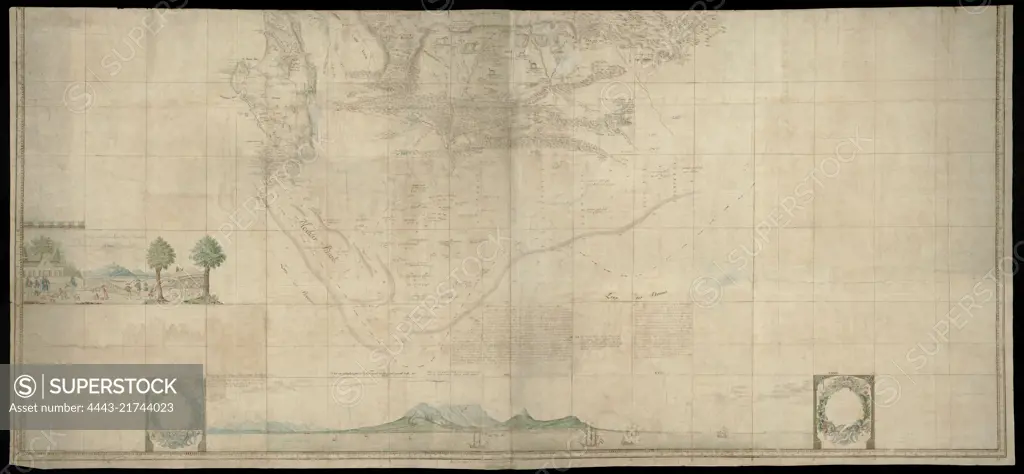
Card in two halves. This part covers the area, bounded to the north by line 32º SB, further by a line running from the northeast from 32º SB to the west coast via Saldanha Bay at 32º SB, the sea is described only south of the coast from Houtbaai to the mouth of the Sunday River. Contains also various images of inhabitants and animals, text accessible by means of a guide map with degree indications, Lower (southern) half or Gordon's great map of Southern Africa., draughtsman: Robert Jacob Gordon, (attributed to), draughtsman: Johannes Schumacher, (possibly), Kaapprovincie, Jan-1786 - Mar-1786, paper, pen, brush, h 925 mm × w 2030 mm, h 900 mm × w 1965 mm
SuperStock offers millions of photos, videos, and stock assets to creatives around the world. This image of Card in two halves. This part covers the area, bounded to the north by line 32º SB, further by a line running from the northeast from 32º SB to the west coast via Saldanha Bay at 32º SB, the sea is described only south of the coast from Houtbaai to the mouth of the Sunday River. Contains also various images of inhabitants and animals, text accessible by means of a guide map with degree indications, Lower (southern) half or Gordon's great map of Southern Africa., draughtsman: Robert Jacob Gordon, (attributed to), draughtsman: Johannes Schumacher, (possibly), Kaapprovincie, Jan-1786 - Mar-1786, paper, pen, brush, h 925 mm × w 2030 mm, h 900 mm × w 1965 mm by Artokoloro is available for licensing today.
Looking for a license?
Click here, and we'll help you find it! Questions? Just ask!
Click here, and we'll help you find it! Questions? Just ask!
DETAILS
Image Number: 4443-21744023Rights ManagedCredit Line:Artokoloro/SuperStockCollection:Artokoloro Model Release:NoProperty Release:NoResolution:10306×4774