The Cantino planisphere (or Cantino World Map) is the earliest surviving map showing Portuguese Discoveries in the east and west. It is named after Alberto Cantino, an agent for the Duke of Ferrara, who successfully smuggled it from Portugal to Italy in 1502. The map is particularly notable for portraying a fragmentary record of the Brazilian coast, discovered in 1500 by the Portuguese explorer Pedro Ålvares Cabral who conjectured that he had landed on a continent previously unknown to Europeans
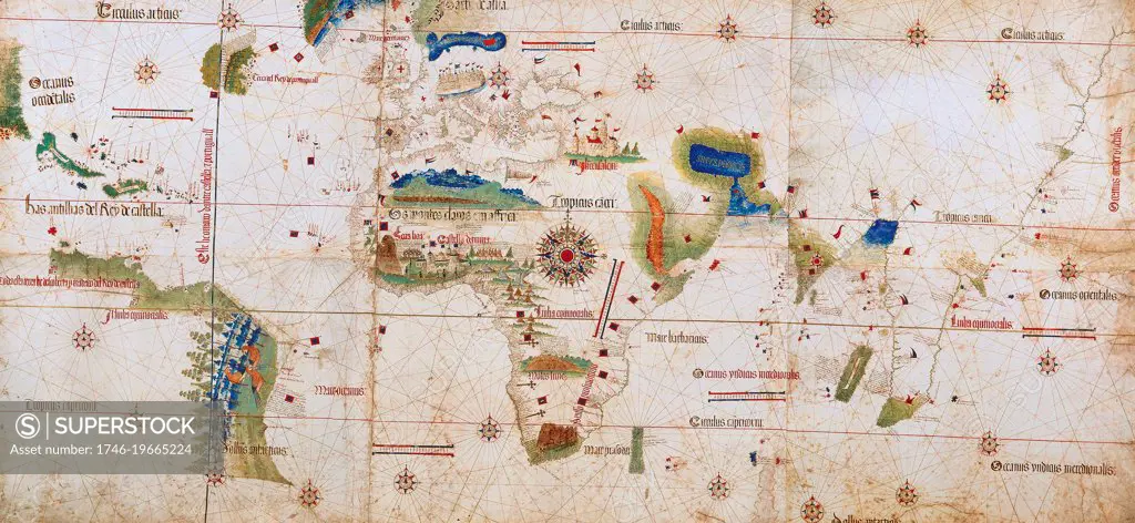
SuperStock offers millions of photos, videos, and stock assets to creatives around the world. This image of The Cantino planisphere (or Cantino World Map) is the earliest surviving map showing Portuguese Discoveries in the east and west. It is named after Alberto Cantino, an agent for the Duke of Ferrara, who successfully smuggled it from Portugal to Italy in 1502. The map is particularly notable for portraying a fragmentary record of the Brazilian coast, discovered in 1500 by the Portuguese explorer Pedro Ålvares Cabral who conjectured that he had landed on a continent previously unknown to Europeans by Image Asset Management/World History Archive is available for licensing today.
Looking for a license?
Click here, and we'll help you find it! Questions? Just ask!
Click here, and we'll help you find it! Questions? Just ask!
DETAILS
Image Number: 1746-19665224Rights ManagedCredit Line:Image Asset Management/World History Archive/SuperStockCollection: