Campaign map of the Department of the Platte comprising that portion of Wyoming, sheet no. 4, 1874. Issued by the United States Army, Office of the Chief of Engineers., 1874, Washington D.C., Publisher, Published by authority of the Hon. Secretary of War in the Office of the Chief of Engineers, U.S. Army. The map features Indian reservations and indicates areas related to the Indians of North America in Wyoming., 1 map; 75 x 42 cm, on sheet 81 x 51 cm. NYPL Map Div. copy has accession no. stamped in lower left corner 59038
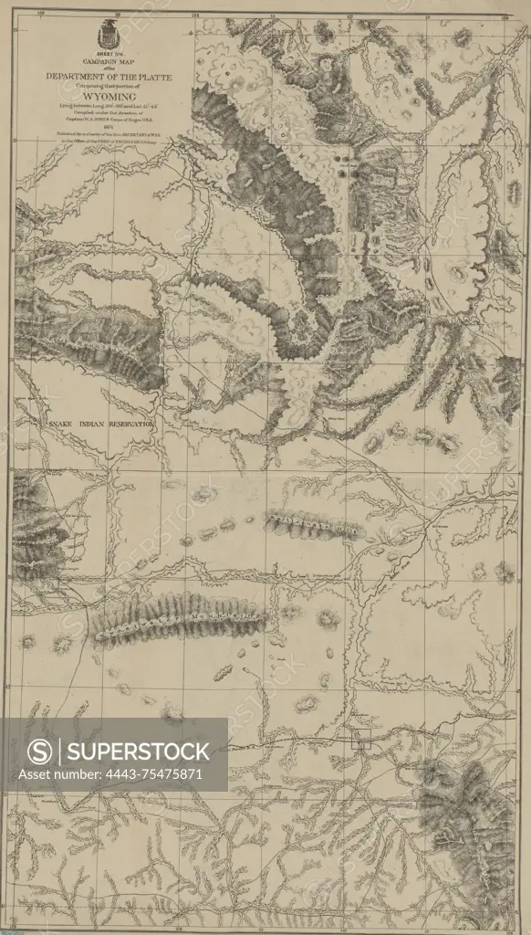
SuperStock offers millions of photos, videos, and stock assets to creatives around the world. This image of Campaign map of the Department of the Platte comprising that portion of Wyoming, sheet no. 4, 1874. Issued by the United States Army, Office of the Chief of Engineers., 1874, Washington D.C., Publisher, Published by authority of the Hon. Secretary of War in the Office of the Chief of Engineers, U.S. Army. The map features Indian reservations and indicates areas related to the Indians of North America in Wyoming., 1 map; 75 x 42 cm, on sheet 81 x 51 cm. NYPL Map Div. copy has accession no. stamped in lower left corner 59038 by Artokoloro is available for licensing today.
Looking for a license?
Click here, and we'll help you find it! Questions? Just ask!
Click here, and we'll help you find it! Questions? Just ask!
DETAILS
Image Number: 4443-75475871Rights ManagedCredit Line:Artokoloro/SuperStockCollection:Artokoloro Model Release:NoProperty Release:NoResolution:3243×5700