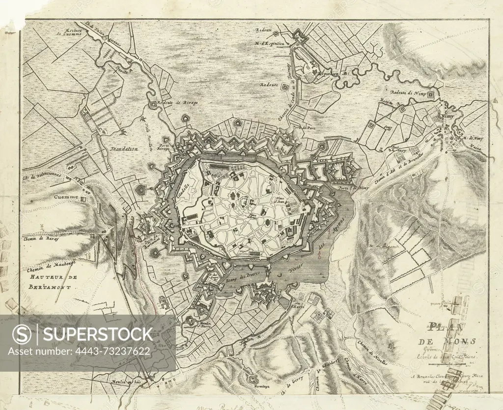
Brussels, Fricx, Eugene Henry, Harrewijn, Jacobus, Plan de Mons, Map of Mons, 1709, Map of Mons (Bergen) on which the location of the besieging Allied troops is added, September-October 1709. A sheet with a drawn addition to the map is glued to the bottom of the print., print, prent, map, prints, pictures, Frederik Muller Historical plates, height 465 mm, width 330 mm, Southern Netherlands, 1660 - 1740, print maker, printmaker, 1709 - 1709, paper, papier, ink, inkt, pencil, etching, etchings, pen, Publication (Event), Publicatie, publisher
SuperStock offers millions of photos, videos, and stock assets to creatives around the world. This image of Brussels, Fricx, Eugene Henry, Harrewijn, Jacobus, Plan de Mons, Map of Mons, 1709, Map of Mons (Bergen) on which the location of the besieging Allied troops is added, September-October 1709. A sheet with a drawn addition to the map is glued to the bottom of the print., print, prent, map, prints, pictures, Frederik Muller Historical plates, height 465 mm, width 330 mm, Southern Netherlands, 1660 - 1740, print maker, printmaker, 1709 - 1709, paper, papier, ink, inkt, pencil, etching, etchings, pen, Publication (Event), Publicatie, publisher by Artokoloro is available for licensing today.
Looking for a license?
Click here, and we'll help you find it! Questions? Just ask!
Click here, and we'll help you find it! Questions? Just ask!
DETAILS
Image Number: 4443-73237622Rights ManagedCredit Line:Artokoloro/SuperStockCollection:Artokoloro Model Release:NoProperty Release:NoResolution:3741×3048