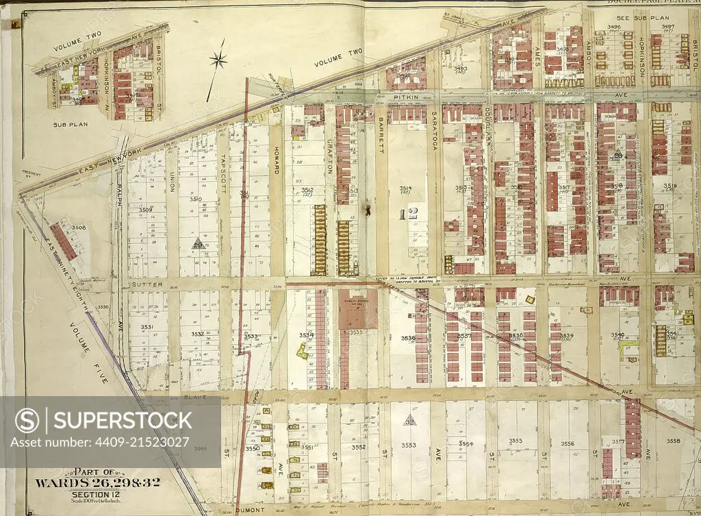
Brooklyn, Vol. 4, Double Page Plate No. 1; Part of Wards 26, 29 & 32, Section 12; Map bounded by East New York Ave., St. Johns Pl., Bristol St. Including Dumont Ave., East Ninetyeight St.; Sub Plan; Map bounded by East New York Ave., Bris.
SuperStock offers millions of photos, videos, and stock assets to creatives around the world. This image of Explore Historic Urban Planning: Detailed Vintage Map Showcasing City Wards and Streets by quintlox/Album Archivo/Album is available for licensing today.
Looking for a license?
Click here, and we'll help you find it! Questions? Just ask!
Click here, and we'll help you find it! Questions? Just ask!
DETAILS
Image Number: 4409-21523027Rights ManagedCredit Line:quintlox/Album Archivo/Album/SuperStockCollection:Album Archivo Contributor:quintlox Model Release:NoProperty Release:NoResolution:6400×4708