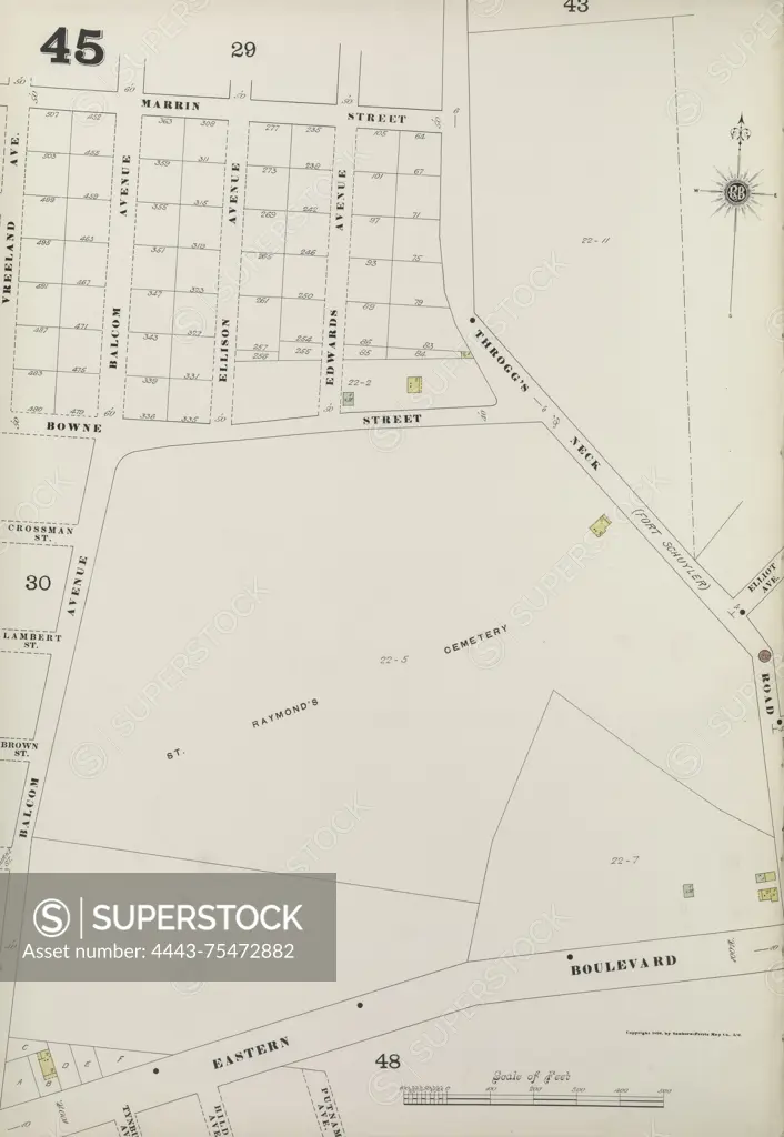
Bronx, V. A, Plate No. 45 Map bounded by Marrin St., Throgg's Neck Rd., Eastern Blvd., and Balcom Ave., Sanborn Map Company, 1884-1898, New York. Fire insurance map depicting real property in New York State cities and towns
SuperStock offers millions of photos, videos, and stock assets to creatives around the world. This image of Bronx, V. A, Plate No. 45 Map bounded by Marrin St., Throgg's Neck Rd., Eastern Blvd., and Balcom Ave., Sanborn Map Company, 1884-1898, New York. Fire insurance map depicting real property in New York State cities and towns by Artokoloro is available for licensing today.
Looking for a license?
Click here, and we'll help you find it! Questions? Just ask!
Click here, and we'll help you find it! Questions? Just ask!
DETAILS
Image Number: 4443-75472882Rights ManagedCredit Line:Artokoloro/SuperStockCollection:Artokoloro Model Release:NoProperty Release:NoResolution:3933×5700