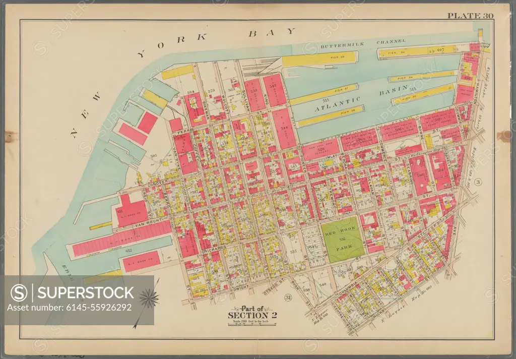
Bromley, George Washington. Cartographic, Maps, Atlases, land surveys. 1908. Lionel Pincus and Princess Firyal Map Division. Brooklyn (New York, N.Y.) , Maps Plate 30: Bounded by (New York Bay Piers) Ferris Street, Pioneer Street, (Atlantic Basin) Imlay Street, Hamilton Avenue, Hicks Street, Centre Street, Columbia Street, Bush Street, Otswego Street, Wolcott Street, Dwight Street, Beard Street, (Erie Basin) Van Brunt Street, Reid Street and Van Dyke Street Plate 30
SuperStock offers millions of photos, videos, and stock assets to creatives around the world. This image of Bromley, George Washington. Cartographic, Maps, Atlases, land surveys. 1908. Lionel Pincus and Princess Firyal Map Division. Brooklyn (New York, N.Y.) , Maps Plate 30: Bounded by (New York Bay Piers) Ferris Street, Pioneer Street, (Atlantic Basin) Imlay Street, Hamilton Avenue, Hicks Street, Centre Street, Columbia Street, Bush Street, Otswego Street, Wolcott Street, Dwight Street, Beard Street, (Erie Basin) Van Brunt Street, Reid Street and Van Dyke Street Plate 30 by Piemags/PL Photography Limited is available for licensing today.
Looking for a license?
Click here, and we'll help you find it! Questions? Just ask!
Click here, and we'll help you find it! Questions? Just ask!
DETAILS
Image Number: 6145-55926292Royalty FreeCredit Line:Piemags/PL Photography Limited/SuperStockCollection:PL Photography Limited Contributor:Piemags Model Release:NoProperty Release:NoResolution:11184×7777