Bonner's pocket map of the state of Georgia, 1849. It features hand coloring and measures 48 x 42 cm on a sheet that is 52 x 44 cm, contained in a folder measuring 13 x 9 cm. The map includes details of railroads as well as administrative and political divisions within Georgia. Published by Wm. G. Bonner in Milledgeville, Georgia
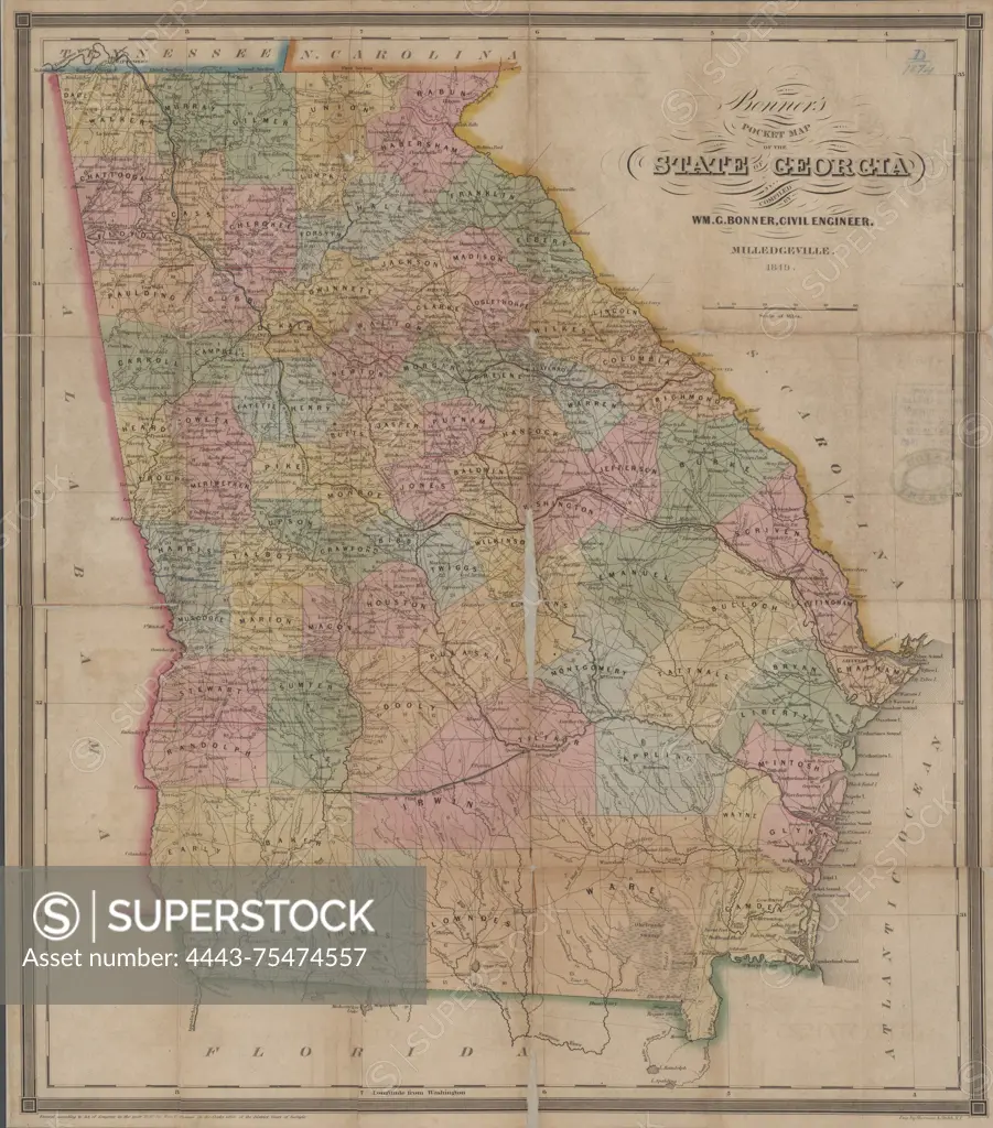
SuperStock offers millions of photos, videos, and stock assets to creatives around the world. This image of Bonner's pocket map of the state of Georgia, 1849. It features hand coloring and measures 48 x 42 cm on a sheet that is 52 x 44 cm, contained in a folder measuring 13 x 9 cm. The map includes details of railroads as well as administrative and political divisions within Georgia. Published by Wm. G. Bonner in Milledgeville, Georgia by Artokoloro is available for licensing today.
Looking for a license?
Click here, and we'll help you find it! Questions? Just ask!
Click here, and we'll help you find it! Questions? Just ask!
DETAILS
Image Number: 4443-75474557Rights ManagedCredit Line:Artokoloro/SuperStockCollection:Artokoloro Model Release:NoProperty Release:NoResolution:5019×5700