1770 Bonne Map of East Africa, Madagascar, Isle Bourbon and Mauritius (Mozambique)
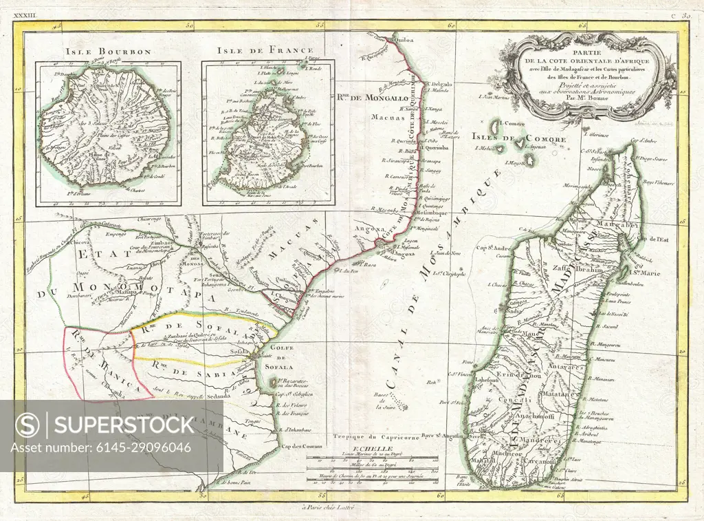
SuperStock offers millions of photos, videos, and stock assets to creatives around the world. This image of Vintage 18th Century Map of Madagascar and Surroundings: Historical Cartography and Exploration Insights by Piemags/PL Photography Limited is available for licensing today.
DETAILS
Image Number: 6145-29096046Royalty FreeCredit Line:Piemags/PL Photography Limited/SuperStockCollection: