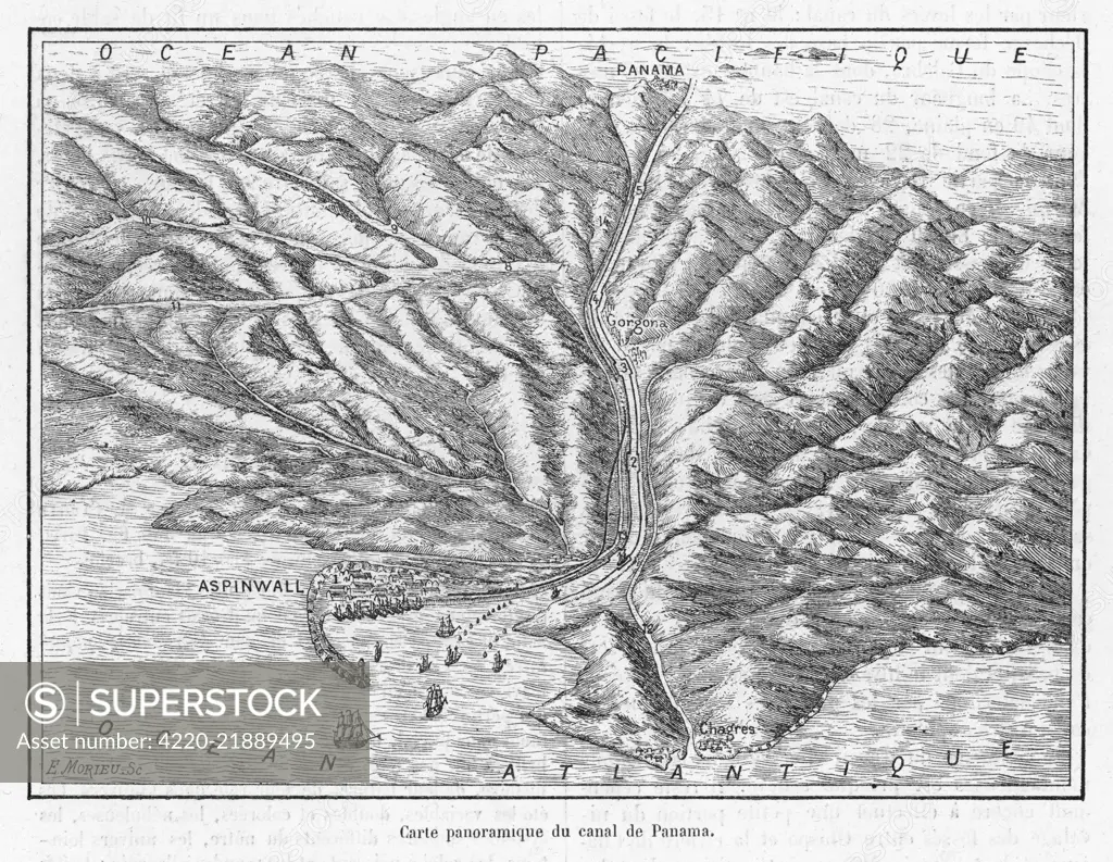
A bird's eye view of the canal as planned by the French, whose project will have to be abandoned, and completed by the Americans. Date: 1881
SuperStock offers millions of photos, videos, and stock assets to creatives around the world. This image of Explore the Historic Map of the Panama Canal - Vintage 19th-Century Cartography by Mary Evans Picture Library/Pantheon is available for licensing today.
Looking for a license?
Click here, and we'll help you find it! Questions? Just ask!
Click here, and we'll help you find it! Questions? Just ask!
DETAILS
Image Number: 4220-21889495Rights ManagedCredit Line:Mary Evans Picture Library/Pantheon/SuperStockCollection:Mary Evans Picture Library Model Release:YesProperty Release:NoResolution:4906×3804