1865 Bellin Sea Chart of Western Africa ( Senegal, Gambia, Guinea, etc.)
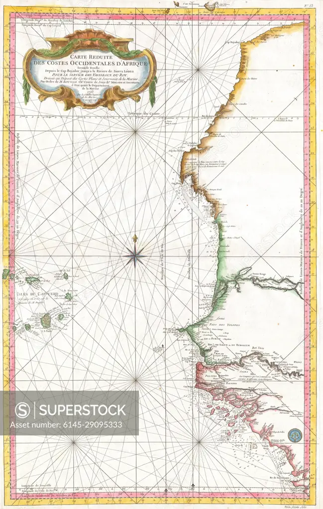
SuperStock offers millions of photos, videos, and stock assets to creatives around the world. This image of Explore Historical Navigation with an 18th-Century Maritime Map of the African West Coast by Piemags/PL Photography Limited is available for licensing today.
DETAILS
Image Number: 6145-29095333Royalty FreeCredit Line:Piemags/PL Photography Limited/SuperStockCollection: