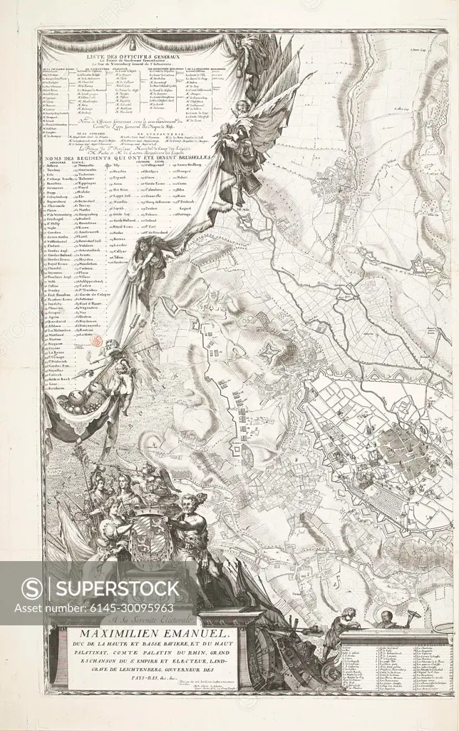
Beleg van Brussel (linkerhelft), 1697; Plan de la ville de Brusselles avec la situation, les retranchemens et campemens des armées des alliez sous le commendement de sa majesté Britannique au mois d'août l án 1697.Leerh half of a large map of Brussels and the surrounding area during the siege of the city by the Allies under King Willem III from August 1697. On the left a curtain ceased by angels with lists of the officers and regiments, bottom left a cartouche with allegorical figures and the assignment in French. At the bottom of a part of the legend 1-48 in French.
SuperStock offers millions of photos, videos, and stock assets to creatives around the world. This image of Beleg van Brussel (linkerhelft), 1697; Plan de la ville de Brusselles avec la situation, les retranchemens et campemens des armées des alliez sous le commendement de sa majesté Britannique au mois d'août l án 1697.Leerh half of a large map of Brussels and the surrounding area during the siege of the city by the Allies under King Willem III from August 1697. On the left a curtain ceased by angels with lists of the officers and regiments, bottom left a cartouche with allegorical figures and the assignment in French. At the bottom of a part of the legend 1-48 in French. by Piemags/PL Photography Limited is available for licensing today.
Looking for a license?
Click here, and we'll help you find it! Questions? Just ask!
Click here, and we'll help you find it! Questions? Just ask!
DETAILS
Image Number: 6145-30095963Royalty FreeCredit Line:Piemags/PL Photography Limited/SuperStockCollection:PL Photography Limited Contributor:Piemags Model Release:NoProperty Release:NoResolution:1573×2500