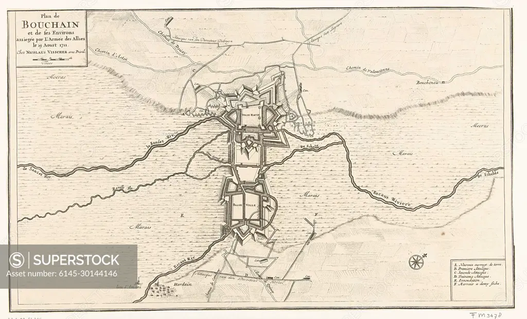
Beleg van Bouchain, 1711; Plan de Bouchain et de ses Environs assiegée par L'Armée des Allies le 19 Aoust 1711.Map of the Northern French town of Bouchain with its reinforcements, Bestorped from August 7 and taken by the Allies on September 12, 1711. At the bottom right of the legend A-F in French.
SuperStock offers millions of photos, videos, and stock assets to creatives around the world. This image of Beleg van Bouchain, 1711; Plan de Bouchain et de ses Environs assiegée par L'Armée des Allies le 19 Aoust 1711.Map of the Northern French town of Bouchain with its reinforcements, Bestorped from August 7 and taken by the Allies on September 12, 1711. At the bottom right of the legend A-F in French. by Piemags/PL Photography Limited is available for licensing today.
Looking for a license?
Click here, and we'll help you find it! Questions? Just ask!
Click here, and we'll help you find it! Questions? Just ask!
DETAILS
Image Number: 6145-30144146Royalty FreeCredit Line:Piemags/PL Photography Limited/SuperStockCollection:PL Photography Limited Contributor:Piemags Model Release:NoProperty Release:NoResolution:2500×1517