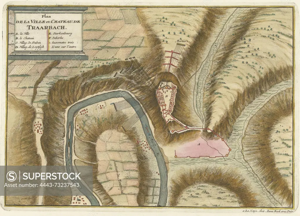
bekend, Den Haag, Beeck, Anna, Northern Netherlands, Call, Jan van (II), Plan de la Ville et: Chateau: de Traarbach, Plan of village and castle of Trarbach, 1704, unknown, The Hague, Map of the fortifications around the town of Trarbach and the castle, besieged by the imperial troops and captured on 18 December 1704. The sheet is glued to the map of Trier., print, prent, map, prints, Frederik Muller Historieplaten, height 246 mm, width 349 mm, 1689 - 1756, print maker, printmaker, 1704 - 1704, paper, papier, etching, etchings, hand colouring, Publication (Event), Publication, Dutch, 1657 - 1717, publisher, uitgever van privilege
SuperStock offers millions of photos, videos, and stock assets to creatives around the world. This image of bekend, Den Haag, Beeck, Anna, Northern Netherlands, Call, Jan van (II), Plan de la Ville et: Chateau: de Traarbach, Plan of village and castle of Trarbach, 1704, unknown, The Hague, Map of the fortifications around the town of Trarbach and the castle, besieged by the imperial troops and captured on 18 December 1704. The sheet is glued to the map of Trier., print, prent, map, prints, Frederik Muller Historieplaten, height 246 mm, width 349 mm, 1689 - 1756, print maker, printmaker, 1704 - 1704, paper, papier, etching, etchings, hand colouring, Publication (Event), Publication, Dutch, 1657 - 1717, publisher, uitgever van privilege by Artokoloro is available for licensing today.
Looking for a license?
Click here, and we'll help you find it! Questions? Just ask!
Click here, and we'll help you find it! Questions? Just ask!
DETAILS
Image Number: 4443-73237543Rights ManagedCredit Line:Artokoloro/SuperStockCollection:Artokoloro Model Release:NoProperty Release:NoResolution:5459×3936