Beers' new map of Staten Island, published in 1887 by J.B. Beers & Co. This hand-colored map measures 117 x 73 cm and includes detailed surveys of landowners and real property in Staten Island, New York
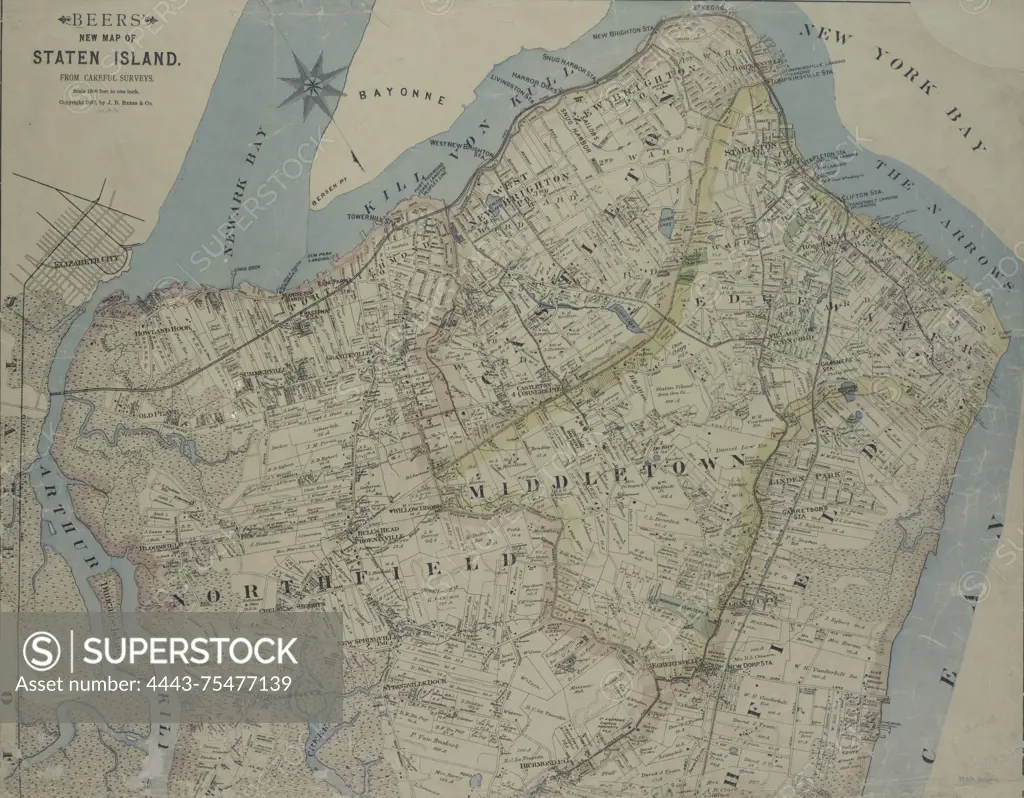
SuperStock offers millions of photos, videos, and stock assets to creatives around the world. This image of Beers' new map of Staten Island, published in 1887 by J.B. Beers & Co. This hand-colored map measures 117 x 73 cm and includes detailed surveys of landowners and real property in Staten Island, New York by Artokoloro is available for licensing today.
Looking for a license?
Click here, and we'll help you find it! Questions? Just ask!
Click here, and we'll help you find it! Questions? Just ask!
DETAILS
Image Number: 4443-75477139Rights ManagedCredit Line:Artokoloro/SuperStockCollection:Artokoloro Model Release:NoProperty Release:NoResolution:5856×4565