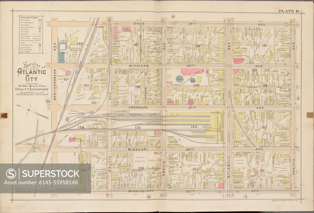
Atlantic City, Double Page Plate No. 10 Map bounded by Ohio Ave., Pacific Ave., Mississippi Ave., Mediterranean Ave. Cartographic. Atlases, Maps. 1896. Lionel Pincus and Princess Firyal Map Division. Atlantic City (N.J.)
SuperStock offers millions of photos, videos, and stock assets to creatives around the world. This image of Atlantic City, Double Page Plate No. 10 Map bounded by Ohio Ave., Pacific Ave., Mississippi Ave., Mediterranean Ave. Cartographic. Atlases, Maps. 1896. Lionel Pincus and Princess Firyal Map Division. Atlantic City (N.J.) by Piemags/PL Photography Limited is available for licensing today.
Looking for a license?
Click here, and we'll help you find it! Questions? Just ask!
Click here, and we'll help you find it! Questions? Just ask!
DETAILS
Image Number: 6145-55958148Royalty FreeCredit Line:Piemags/PL Photography Limited/SuperStockCollection:PL Photography Limited Story:Historical City MapsContributor:Piemags Model Release:NoProperty Release:NoResolution:6292×4261