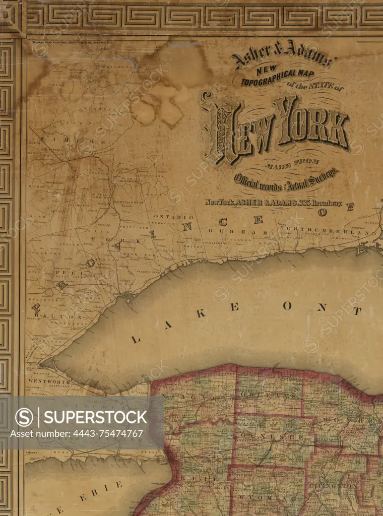
Asher & Adams' new topographical map of the state of New York, made from official records and actual surveys, 1869. Additional, New topographical map of the state of New York., 1869., New York, N.Y. Publisher, Asher & Adams., 1 map color; 135 x 159 cm, on sheet 149 x 173 cm
SuperStock offers millions of photos, videos, and stock assets to creatives around the world. This image of Asher & Adams' new topographical map of the state of New York, made from official records and actual surveys, 1869. Additional, New topographical map of the state of New York., 1869., New York, N.Y. Publisher, Asher & Adams., 1 map color; 135 x 159 cm, on sheet 149 x 173 cm by Artokoloro is available for licensing today.
Looking for a license?
Click here, and we'll help you find it! Questions? Just ask!
Click here, and we'll help you find it! Questions? Just ask!
DETAILS
Image Number: 4443-75474767Rights ManagedCredit Line:Artokoloro/SuperStockCollection:Artokoloro Model Release:NoProperty Release:NoResolution:4234×5700