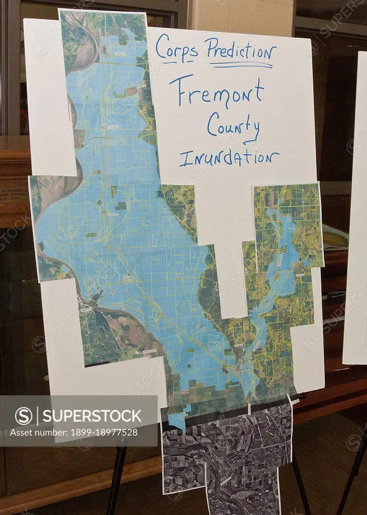
An Army Corps of Engineers Inundation Map representing the possible coverage of the Missouri River floodwaters posted during a town hall meeting held buy Agriculture Secretary Tom Vilsack at the Glenwood Community High School in Glenwood, Iowa Thur., June 16, 2011.
SuperStock offers millions of photos, videos, and stock assets to creatives around the world. This image of An Army Corps of Engineers Inundation Map representing the possible coverage of the Missouri River floodwaters posted during a town hall meeting held buy Agriculture Secretary Tom Vilsack at the Glenwood Community High School in Glenwood, Iowa Thur., June 16, 2011. by HUM Images/Universal Images is available for licensing today.
Looking for a license?
Click here, and we'll help you find it! Questions? Just ask!
Click here, and we'll help you find it! Questions? Just ask!
DETAILS
Image Number: 1899-18977528Rights ManagedCredit Line:HUM Images/Universal Images/SuperStockCollection:Universal Images Contributor:HUM Images Model Release:NoProperty Release:NoResolution:1500×2100