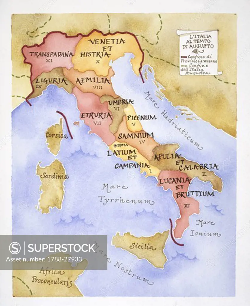
Ancient Rome. Map of regional Italy in Augustan Age, 1st century BC. Regions: Latium et Campania; II Apulia et Calabria; III Lucania et Bruttii; IV Samnium; V Picenum; VI Umbria; VII Etruria; VIII Aemilia; IX Liguria; X Venetia et Histria; XI Transpadana.
SuperStock offers millions of photos, videos, and stock assets to creatives around the world. This image of Ancient Rome. Map of regional Italy in Augustan Age, 1st century BC. Regions: Latium et Campania; II Apulia et Calabria; III Lucania et Bruttii; IV Samnium; V Picenum; VI Umbria; VII Etruria; VIII Aemilia; IX Liguria; X Venetia et Histria; XI Transpadana. by DeAgostini is available for licensing today.
Looking for a license?
Click here, and we'll help you find it! Questions? Just ask!
Click here, and we'll help you find it! Questions? Just ask!
DETAILS
Image Number: 1788-27933Rights ManagedCredit Line:DeAgostini/SuperStockCollection:DeAgostini Model Release:NoProperty Release:NoResolution:3130×3831