Amsterdam, Visscher, Claes Jansz. (II), The most recent corrected and improved map of Breda, With a short and concise story of the city, its situation, experiences and changes, brought about by the Dutch Wars, Text sheet with the map of the siege of Breda (left half), 1637, Text sheet with the map of the siege of Breda by the Dutch army under Frederik Hendrick, 23 July - 10 October 1637. Text sheet (left half) with a description of the events in 3 long columns., text sheet, news print, prints, Frederik Muller Historieplaten, height 190 mm, width 240 mm, Publication (Event), Publication, Northern Netherlands, 1586 - 1652-06-19, publisher, uitgever, 1637 - 1637, second quarter 17th century, paper, papier, letterpress printing, hand coloring
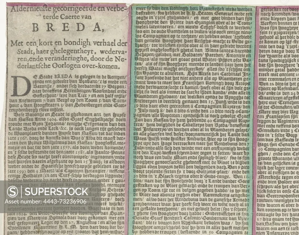
SuperStock offers millions of photos, videos, and stock assets to creatives around the world. This image of Amsterdam, Visscher, Claes Jansz. (II), The most recent corrected and improved map of Breda, With a short and concise story of the city, its situation, experiences and changes, brought about by the Dutch Wars, Text sheet with the map of the siege of Breda (left half), 1637, Text sheet with the map of the siege of Breda by the Dutch army under Frederik Hendrick, 23 July - 10 October 1637. Text sheet (left half) with a description of the events in 3 long columns., text sheet, news print, prints, Frederik Muller Historieplaten, height 190 mm, width 240 mm, Publication (Event), Publication, Northern Netherlands, 1586 - 1652-06-19, publisher, uitgever, 1637 - 1637, second quarter 17th century, paper, papier, letterpress printing, hand coloring by Artokoloro is available for licensing today.
Looking for a license?
Click here, and we'll help you find it! Questions? Just ask!
Click here, and we'll help you find it! Questions? Just ask!
DETAILS
Image Number: 4443-73236906Rights ManagedCredit Line:Artokoloro/SuperStockCollection:Artokoloro Model Release:NoProperty Release:NoResolution:4178×3292