Amsterdam, Visscher, Claes Jansz. (II), Map of the Waal and a view of Schenckenschans, 1635-1636, Sheet with two representations. Above a map with part of the course of the Waal at the stadtholder's quarters at Pannerden, past Schenckenschans. At the bottom of the representation a pile of weapons with banners and some weapons. At the bottom a view of Schenckenschans from the Rhine. The sheet was used in an ensemble with a map of the siege and capture of Schenckenschans by the Dutch army under Frederik Hendrik, 1635-1636., print, prent, kaart, nieuwsprent, prints, prenten, Frederik Muller Historieplaten, height 470 mm, width 430 mm, Noord-Nederlands, 1586 - 1652-06-19, print maker, prentmaker, 1635 - 1636, second quarter 17th century, tweede kwart 17e eeuw, paper, papier, etching, etsen, Publication (Event), Publication, Northern Netherlands, publisher
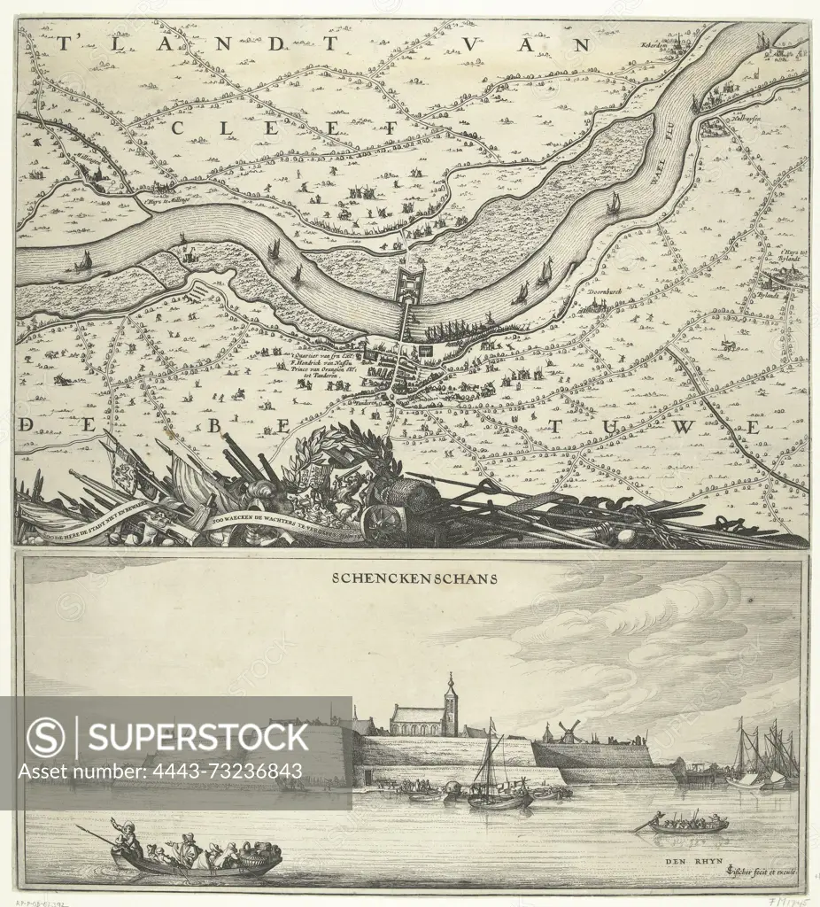
SuperStock offers millions of photos, videos, and stock assets to creatives around the world. This image of Amsterdam, Visscher, Claes Jansz. (II), Map of the Waal and a view of Schenckenschans, 1635-1636, Sheet with two representations. Above a map with part of the course of the Waal at the stadtholder's quarters at Pannerden, past Schenckenschans. At the bottom of the representation a pile of weapons with banners and some weapons. At the bottom a view of Schenckenschans from the Rhine. The sheet was used in an ensemble with a map of the siege and capture of Schenckenschans by the Dutch army under Frederik Hendrik, 1635-1636., print, prent, kaart, nieuwsprent, prints, prenten, Frederik Muller Historieplaten, height 470 mm, width 430 mm, Noord-Nederlands, 1586 - 1652-06-19, print maker, prentmaker, 1635 - 1636, second quarter 17th century, tweede kwart 17e eeuw, paper, papier, etching, etsen, Publication (Event), Publication, Northern Netherlands, publisher by Artokoloro is available for licensing today.
Looking for a license?
Click here, and we'll help you find it! Questions? Just ask!
Click here, and we'll help you find it! Questions? Just ask!
DETAILS
Image Number: 4443-73236843Rights ManagedCredit Line:Artokoloro/SuperStockCollection:Artokoloro Model Release:NoProperty Release:NoResolution:4669×5162