Amsterdam, Tirion, Isaak, Northern Netherlands, Old Map of the now United Netherlands to clarify the history of the Fatherland in the Middle Ages, Map of the Netherlands in the Middle Ages, Map of the Netherlands in the Middle Ages., print, picture, historical picture, map, prints, pictures, Frederik Muller Historieplaten, height 288 mm, width 330 mm, print maker, printmaker, 1749 - 1749, second quarter 18th century, second quarter of the 18th century, paper, etching, etchings, engraving, engraving (printing process), Publication (Event), Publication, 1705 - 1765, publisher
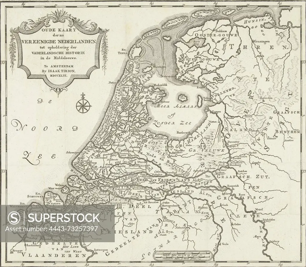
SuperStock offers millions of photos, videos, and stock assets to creatives around the world. This image of Amsterdam, Tirion, Isaak, Northern Netherlands, Old Map of the now United Netherlands to clarify the history of the Fatherland in the Middle Ages, Map of the Netherlands in the Middle Ages, Map of the Netherlands in the Middle Ages., print, picture, historical picture, map, prints, pictures, Frederik Muller Historieplaten, height 288 mm, width 330 mm, print maker, printmaker, 1749 - 1749, second quarter 18th century, second quarter of the 18th century, paper, etching, etchings, engraving, engraving (printing process), Publication (Event), Publication, 1705 - 1765, publisher by Artokoloro is available for licensing today.
Looking for a license?
Click here, and we'll help you find it! Questions? Just ask!
Click here, and we'll help you find it! Questions? Just ask!
DETAILS
Image Number: 4443-73257397Rights ManagedCredit Line:Artokoloro/SuperStockCollection:Artokoloro Model Release:NoProperty Release:NoResolution:4490×3922