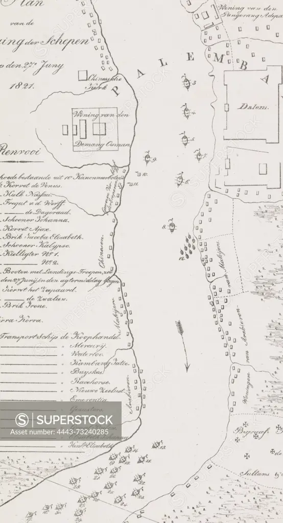
Amsterdam, Spin, Christiaan Andersen, Netherlands, Plan of the Location of Ships on 27 June 1821, Map of the river at Palembang, 1821, verso - stamped, Map of the river at Palembang with the location of the Dutch ships on 27 June 1821 during the Second expedition to Palembang on Sumatra. On the left the legend 1-30. See also the pendant., print, prent, map, prints, Frederik Muller Historieplaten, height 395 mm, width 214 mm, print maker, printmaker, 1821 - 1821, paper, papier, lithografie (techniek), Publication (Event), Publicatie, 1792-02-24 - 1865-10-30, publisher
SuperStock offers millions of photos, videos, and stock assets to creatives around the world. This image of Amsterdam, Spin, Christiaan Andersen, Netherlands, Plan of the Location of Ships on 27 June 1821, Map of the river at Palembang, 1821, verso - stamped, Map of the river at Palembang with the location of the Dutch ships on 27 June 1821 during the Second expedition to Palembang on Sumatra. On the left the legend 1-30. See also the pendant., print, prent, map, prints, Frederik Muller Historieplaten, height 395 mm, width 214 mm, print maker, printmaker, 1821 - 1821, paper, papier, lithografie (techniek), Publication (Event), Publicatie, 1792-02-24 - 1865-10-30, publisher by Artokoloro is available for licensing today.
Looking for a license?
Click here, and we'll help you find it! Questions? Just ask!
Click here, and we'll help you find it! Questions? Just ask!
DETAILS
Image Number: 4443-73240285Rights ManagedCredit Line:Artokoloro/SuperStockCollection:Artokoloro Model Release:NoProperty Release:NoResolution:2502×4618