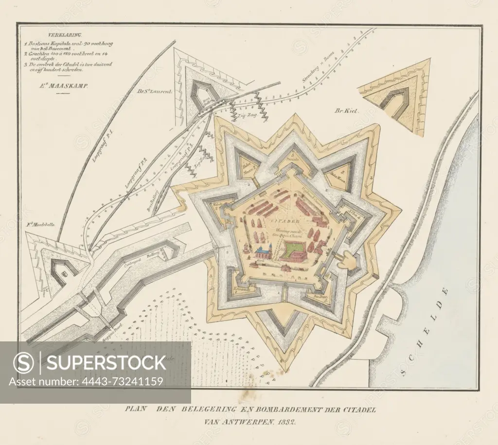
Amsterdam, Maaskamp, Evert, Plan den beleg en bombardement der citadel van Antwerpen, 1832, verso - stamped, Map of the Citadel of Antwerp during the siege by the French army, December 1832. On the left the French trenches and batteries, on the right the Scheldt. Top left the legend 1-3., print, prent, map, prints, prenten, Frederik Muller Historieplaten, height 315 mm, width 415 mm, print maker, prentmaker, 1832 - 1833, paper, papier, lithografie (technique), met de handkleuren, Publication (Event), Publicatie, Noord-Nederlands, 1769-09-27 - 1834-01-31, publisher
SuperStock offers millions of photos, videos, and stock assets to creatives around the world. This image of Amsterdam, Maaskamp, Evert, Plan den beleg en bombardement der citadel van Antwerpen, 1832, verso - stamped, Map of the Citadel of Antwerp during the siege by the French army, December 1832. On the left the French trenches and batteries, on the right the Scheldt. Top left the legend 1-3., print, prent, map, prints, prenten, Frederik Muller Historieplaten, height 315 mm, width 415 mm, print maker, prentmaker, 1832 - 1833, paper, papier, lithografie (technique), met de handkleuren, Publication (Event), Publicatie, Noord-Nederlands, 1769-09-27 - 1834-01-31, publisher by Artokoloro is available for licensing today.
Looking for a license?
Click here, and we'll help you find it! Questions? Just ask!
Click here, and we'll help you find it! Questions? Just ask!
DETAILS
Image Number: 4443-73241159Rights ManagedCredit Line:Artokoloro/SuperStockCollection:Artokoloro Model Release:NoProperty Release:NoResolution:3809×3405