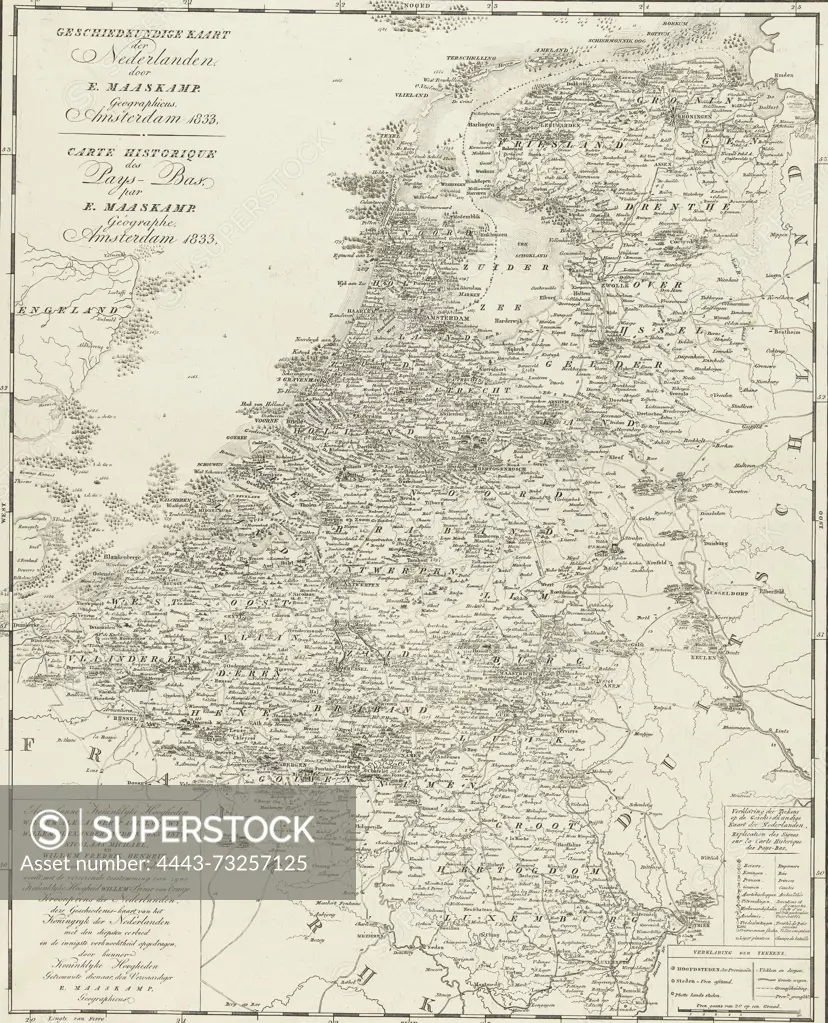
Amsterdam, Maaskamp, Evert, Netherlands, Giersbergen et fils, Historical map of the Netherlands, Carte Historique des Pays-Bas, Historical map of the Netherlands. Place names are accompanied by dates of important events., print, picture, history print, map, prints, pictures, Frederik Muller Historieplaten, height 506 mm, width 403 mm, print maker, printmaker, 1833 - 1833, second quarter 19th century, paper, papier, etching, etchings, Publication (Event), Publicatie, Noord-Nederlands, 1769-09-27 - 1834-01-31, publisher
SuperStock offers millions of photos, videos, and stock assets to creatives around the world. This image of Amsterdam, Maaskamp, Evert, Netherlands, Giersbergen et fils, Historical map of the Netherlands, Carte Historique des Pays-Bas, Historical map of the Netherlands. Place names are accompanied by dates of important events., print, picture, history print, map, prints, pictures, Frederik Muller Historieplaten, height 506 mm, width 403 mm, print maker, printmaker, 1833 - 1833, second quarter 19th century, paper, papier, etching, etchings, Publication (Event), Publicatie, Noord-Nederlands, 1769-09-27 - 1834-01-31, publisher by Artokoloro is available for licensing today.
Looking for a license?
Click here, and we'll help you find it! Questions? Just ask!
Click here, and we'll help you find it! Questions? Just ask!
DETAILS
Image Number: 4443-73257125Rights ManagedCredit Line:Artokoloro/SuperStockCollection:Artokoloro Model Release:NoProperty Release:NoResolution:4470×5523