Amsterdam, Maaskamp, Evert, Netherlands, Five maps of the areas affected by flooding in 1825, Province de la Nord Hollande, Provincie Nood Holland, Map of the Flood of North Holland, on 4 February, 1825, Map of the area in North Holland affected by the floods in 1825, verso - stamped, Map of the province of North Holland, on which the area affected by the floods in February 1825 is indicated in blue. A breached dike is marked in red. At the bottom of the page two lines of manuscript. Part of a series of five maps of the affected areas., print, image, map, prints, images, Frederik Muller Historieplaten, height 247 mm, width 178 mm, print maker, printmaker, 1825 - 1825, paper, engraving, engraving (printing process), hand coloring, Publication (Event), Publication, Noord-Nederlands, 1769-09-27 - 1834-01-31, publisher
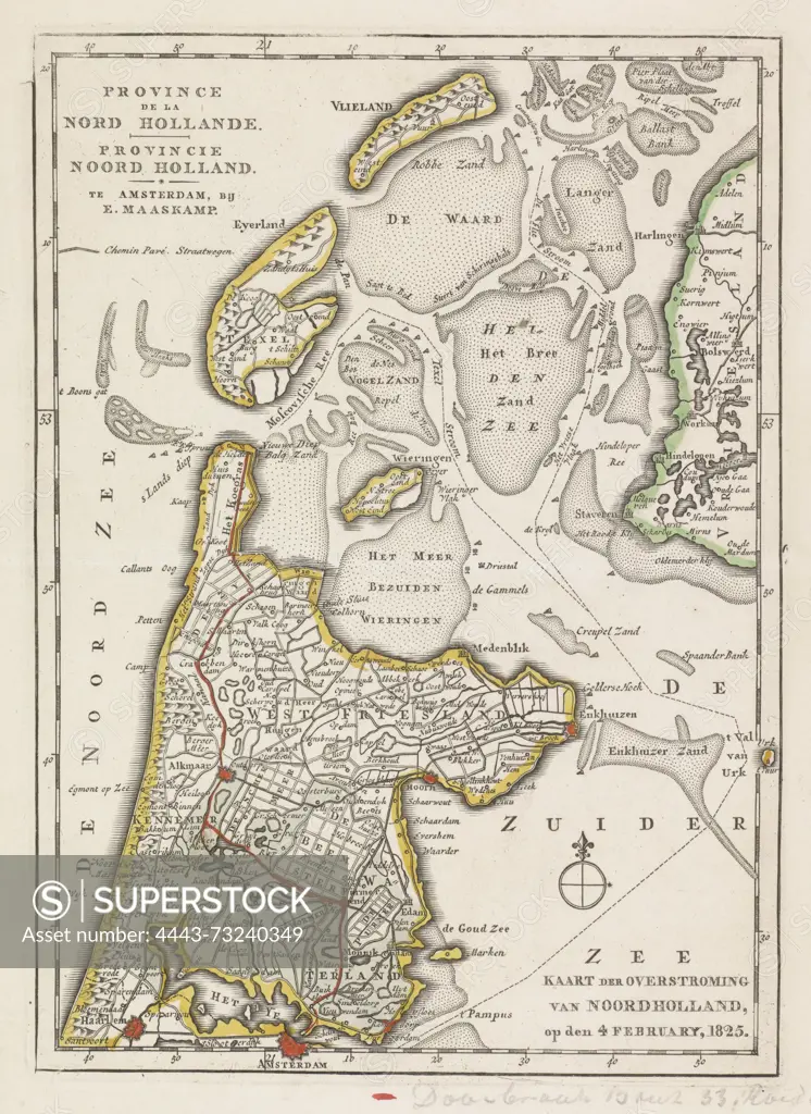
SuperStock offers millions of photos, videos, and stock assets to creatives around the world. This image of Amsterdam, Maaskamp, Evert, Netherlands, Five maps of the areas affected by flooding in 1825, Province de la Nord Hollande, Provincie Nood Holland, Map of the Flood of North Holland, on 4 February, 1825, Map of the area in North Holland affected by the floods in 1825, verso - stamped, Map of the province of North Holland, on which the area affected by the floods in February 1825 is indicated in blue. A breached dike is marked in red. At the bottom of the page two lines of manuscript. Part of a series of five maps of the affected areas., print, image, map, prints, images, Frederik Muller Historieplaten, height 247 mm, width 178 mm, print maker, printmaker, 1825 - 1825, paper, engraving, engraving (printing process), hand coloring, Publication (Event), Publication, Noord-Nederlands, 1769-09-27 - 1834-01-31, publisher by Artokoloro is available for licensing today.
Looking for a license?
Click here, and we'll help you find it! Questions? Just ask!
Click here, and we'll help you find it! Questions? Just ask!
DETAILS
Image Number: 4443-73240349Rights ManagedCredit Line:Artokoloro/SuperStockCollection:Artokoloro Model Release:NoProperty Release:NoResolution:3785×5193