Amsterdam, Maaskamp, Evert, Monogrammist JBDB, Belgium, Maillart, Jeanne, Plan Itinéraire d'Anvers (Antwerp), Map of Antwerp and the Citadel, 1830, verso - stamped, Map of the city of Antwerp with the Citadel, at the time of the bombardment of Antwerp, October 27, 1830. The Dutch warships are indicated on the river, their names are mentioned in the margin on the left. At the bottom the legend 1-32 and two cross-sections of the Citadel., print, engraving, engraving (printing process), hand colouring, Frederik Muller Historieplaten, height 170 mm, width 118 mm, Belgian, 1782, print maker, printmaker, 1830 - 1831, paper, papier, etching, etchings, intermediary draughtsman, after a drawing by, Publication (Event), Publication, Noord-Nederlands, 1769-09-27 - 1834-01-31, publisher
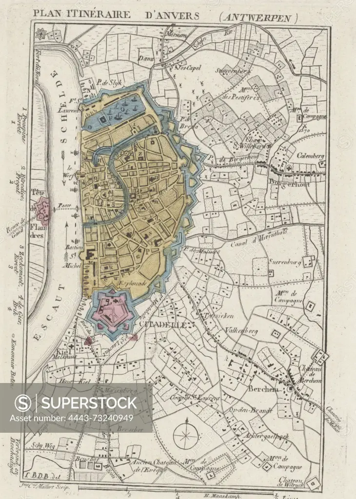
SuperStock offers millions of photos, videos, and stock assets to creatives around the world. This image of Amsterdam, Maaskamp, Evert, Monogrammist JBDB, Belgium, Maillart, Jeanne, Plan Itinéraire d'Anvers (Antwerp), Map of Antwerp and the Citadel, 1830, verso - stamped, Map of the city of Antwerp with the Citadel, at the time of the bombardment of Antwerp, October 27, 1830. The Dutch warships are indicated on the river, their names are mentioned in the margin on the left. At the bottom the legend 1-32 and two cross-sections of the Citadel., print, engraving, engraving (printing process), hand colouring, Frederik Muller Historieplaten, height 170 mm, width 118 mm, Belgian, 1782, print maker, printmaker, 1830 - 1831, paper, papier, etching, etchings, intermediary draughtsman, after a drawing by, Publication (Event), Publication, Noord-Nederlands, 1769-09-27 - 1834-01-31, publisher by Artokoloro is available for licensing today.
Looking for a license?
Click here, and we'll help you find it! Questions? Just ask!
Click here, and we'll help you find it! Questions? Just ask!
DETAILS
Image Number: 4443-73240949Rights ManagedCredit Line:Artokoloro/SuperStockCollection:Artokoloro Model Release:NoProperty Release:NoResolution:2773×3889