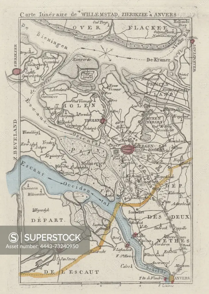
Amsterdam, Maaskamp, Evert, Monogrammist JBDB, Belgium, Carte Itinéraire de Willemstad, Zierikzee à Anvers, Map of the area around Bergen op Zoom, ca. 1830, verso - stamped, ca. 1830. Possibly at the time of the bombardment of Antwerp, October 27, 1830., print, map, prints, Frederik Muller Historieplaten, height 168 mm, width 116 mm, print maker, printmaker, 1830 - 1831, paper, papier, etching, etchings, engraving, engraving (printing process), hand coloring, intermediary draughtsman, after a drawing by, Publication (Event), Publication, Noord-Nederlands, 1769-09-27 - 1834-01-31, publisher
SuperStock offers millions of photos, videos, and stock assets to creatives around the world. This image of Amsterdam, Maaskamp, Evert, Monogrammist JBDB, Belgium, Carte Itinéraire de Willemstad, Zierikzee à Anvers, Map of the area around Bergen op Zoom, ca. 1830, verso - stamped, ca. 1830. Possibly at the time of the bombardment of Antwerp, October 27, 1830., print, map, prints, Frederik Muller Historieplaten, height 168 mm, width 116 mm, print maker, printmaker, 1830 - 1831, paper, papier, etching, etchings, engraving, engraving (printing process), hand coloring, intermediary draughtsman, after a drawing by, Publication (Event), Publication, Noord-Nederlands, 1769-09-27 - 1834-01-31, publisher by Artokoloro is available for licensing today.
Looking for a license?
Click here, and we'll help you find it! Questions? Just ask!
Click here, and we'll help you find it! Questions? Just ask!
DETAILS
Image Number: 4443-73240950Rights ManagedCredit Line:Artokoloro/SuperStockCollection:Artokoloro Model Release:NoProperty Release:NoResolution:2801×3938