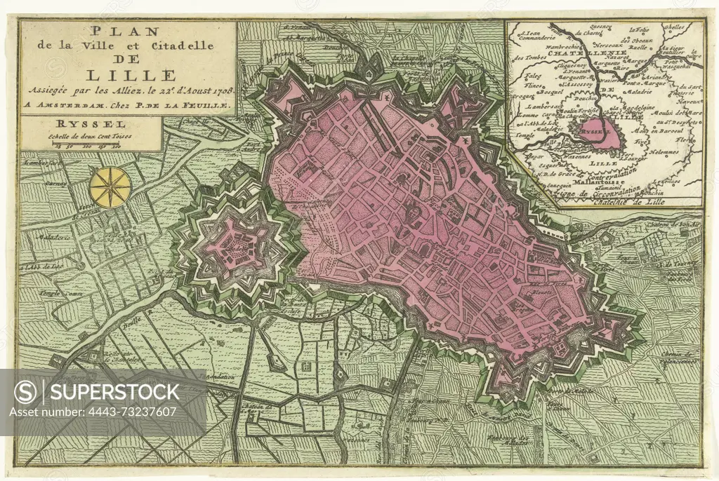
Amsterdam, La Feuille, Paul de, Noordelijke Nederlanden, Plan de la Ville et Citadelle de Lille Assiegée par les Alliez. le 22e. d'Aoust 1708, Plan van het besiege van Lille, 1708, Northern Netherlands, Map of Rijssel (Lille), besieged from 22 August 1708 by the Allies under Prince Eugene of Savoy and Prince Johan Willem Friso. Top right an inset with a map of the larger area., print, map, prints, Frederik Muller Historieplaten, height 173 mm, width 260 mm, print maker, printmaker, 1708 - 1708, paper, papier, etching, etchings, hand coloring, Publication (Event), Publication, publisher
SuperStock offers millions of photos, videos, and stock assets to creatives around the world. This image of Amsterdam, La Feuille, Paul de, Noordelijke Nederlanden, Plan de la Ville et Citadelle de Lille Assiegée par les Alliez. le 22e. d'Aoust 1708, Plan van het besiege van Lille, 1708, Northern Netherlands, Map of Rijssel (Lille), besieged from 22 August 1708 by the Allies under Prince Eugene of Savoy and Prince Johan Willem Friso. Top right an inset with a map of the larger area., print, map, prints, Frederik Muller Historieplaten, height 173 mm, width 260 mm, print maker, printmaker, 1708 - 1708, paper, papier, etching, etchings, hand coloring, Publication (Event), Publication, publisher by Artokoloro is available for licensing today.
Looking for a license?
Click here, and we'll help you find it! Questions? Just ask!
Click here, and we'll help you find it! Questions? Just ask!
DETAILS
Image Number: 4443-73237607Rights ManagedCredit Line:Artokoloro/SuperStockCollection:Artokoloro Model Release:NoProperty Release:NoResolution:5456×3660