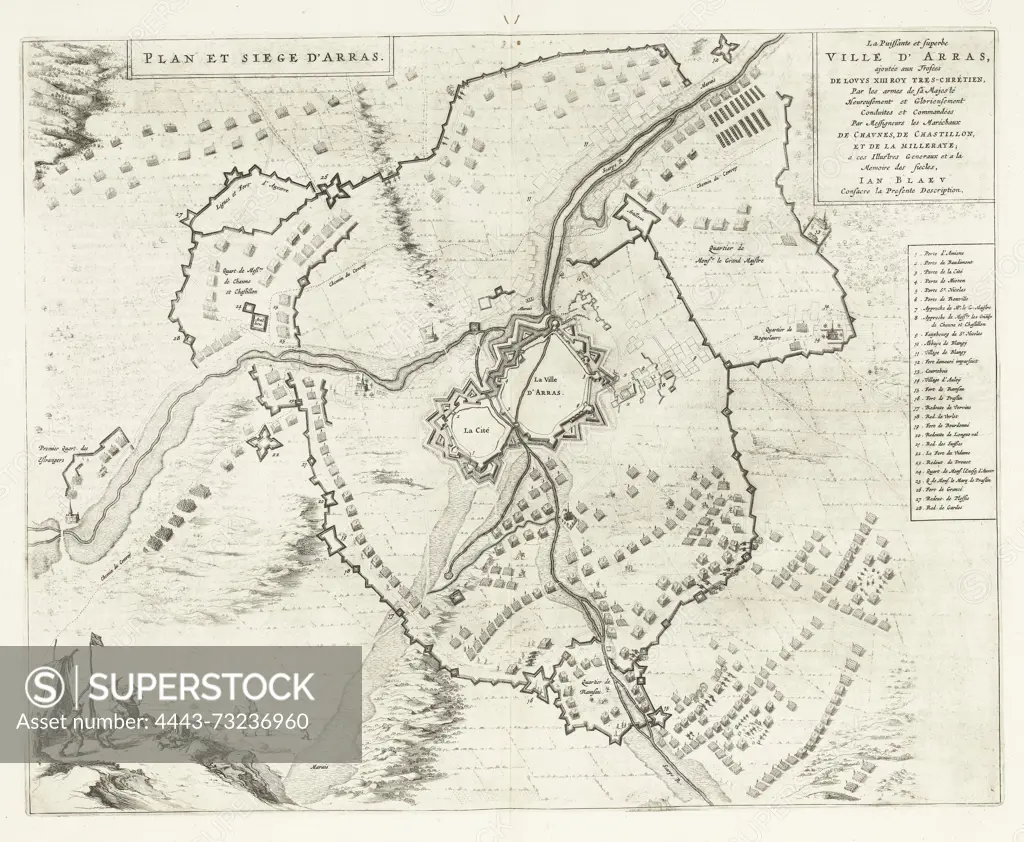
Amsterdam, Blaeu, Johannes Willemszoon, Plan et siege d'Arras, Map of the siege of Arras by the French, 1640, Map of the siege of Arras (Arch) by the French, from 13 July 1640. Map with the city in the middle, around it the positions of the besieging troops. On the right the explanation of the numbers 1-28 in French. On the bottom left a small scene in an army camp with a rider and a beggar. Double page taken from the City Book of Blaeu. With Dutch text on verso., print, history print, map, prints, Frederik Muller History plates, height 423 mm, width 532 mm, print maker, printmaker, 1652 - 1652, paper, etching, etchings, Publication (Event), Publication, Dutch, 1596-09-23 - 1673-05-28, publisher
SuperStock offers millions of photos, videos, and stock assets to creatives around the world. This image of Amsterdam, Blaeu, Johannes Willemszoon, Plan et siege d'Arras, Map of the siege of Arras by the French, 1640, Map of the siege of Arras (Arch) by the French, from 13 July 1640. Map with the city in the middle, around it the positions of the besieging troops. On the right the explanation of the numbers 1-28 in French. On the bottom left a small scene in an army camp with a rider and a beggar. Double page taken from the City Book of Blaeu. With Dutch text on verso., print, history print, map, prints, Frederik Muller History plates, height 423 mm, width 532 mm, print maker, printmaker, 1652 - 1652, paper, etching, etchings, Publication (Event), Publication, Dutch, 1596-09-23 - 1673-05-28, publisher by Artokoloro is available for licensing today.
Looking for a license?
Click here, and we'll help you find it! Questions? Just ask!
Click here, and we'll help you find it! Questions? Just ask!
DETAILS
Image Number: 4443-73236960Rights ManagedCredit Line:Artokoloro/SuperStockCollection:Artokoloro Model Release:NoProperty Release:NoResolution:4554×3747