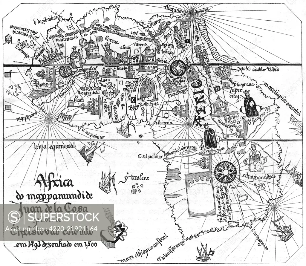
The African continent as mapped by Juan de la Costa, one of Columbus's pilots. The coasts are reasonably defined but inland regions owe more to imagination than observation. Date: 16th century
SuperStock offers millions of photos, videos, and stock assets to creatives around the world. This image of Explore the Historical 1500 Map by Juan de la Cosa: A Glimpse into Early Cartography and Exploration Routes. by Mary Evans Picture Library/Pantheon is available for licensing today.
Looking for a license?
Click here, and we'll help you find it! Questions? Just ask!
Click here, and we'll help you find it! Questions? Just ask!
DETAILS
Image Number: 4220-21921164Rights ManagedCredit Line:Mary Evans Picture Library/Pantheon/SuperStockCollection:Mary Evans Picture Library Model Release:NoProperty Release:NoResolution:4600×4002